Morayfield geodata
Morayfield (Queensland) is a section of populated place; located in Australia in Australia/Brisbane (GMT+10) time zone. With population of 21,221 people, there are 149 cities with bigger population in this country. Compared to other cities in Australia, 85.3% of cities are located further ↓South; 89.5% of cities are located further ←West and 91.8% of cities have higher elevation than Morayfield. Note1


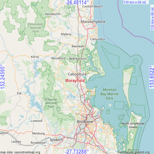
Morayfield GPS coordinates[2]
27° 6' 31.536" South, 152° 56' 56.652" East
| Map corner | latitude | longitude |
|---|---|---|
| Upper-left | -26.48114°, | 152.24595° |
| Center: | -27.10876°, | 152.94907° |
| Lower-right: | -27.73288°, | 153.6522° |
| Map W x H: | 139.2×139.2 km | = 86.5×86.5mi |
| max Lat: | -10.58257° ⇑14.7% North |
| Morayfield: | -27.10876° |
| min Lat: | ⇓85.3% South -43.31423° |
| min Long | Morayfield | max Long |
| 113.53327° | 152.94907° | 153.61246° |
| W 89.5%⇐ | ⇒10.5% E |
Elevation
Elevation of Morayfield is 8 m = 26 ft, and this is 114 m = 374 ft below average elevation for this country.
| Max E: |
1715 m = 5627 ft | 91.8% |
| Avg. | 122 m = 400 ft | |
| Morayfield | 8 m = 26 ft | |
Min E: |
-2 m = -7 ft | 8.2% |
See also: Australia elevation on elevation.city.
Geographical zone
Morayfield is located in South temperate zone (between Tropic of Capricorn and the Antarctic Circle). Distance of this Southern Tropic circle is 408.3 km =253.7 mi to North.| Distance of | km | miles | from Morayfield |
|---|---|---|---|
| Equator | 3014.2 | 1872.9 | to North |
| Tropic Capricorn | 408.3 | 253.7 | to North |
| Antarctic Circle | 4387 | 2726 | to South |
| South Pole | 6992.9 | 4345.2 | to South |


Nearby cities:
15 places around Morayfield: (largest is in red/bold)
• Beachmere
10.5 km =6.5 mi,  101°
101°
• Bellmere
6.4 km =4 mi,  294°
294°
• Burpengary
5.5 km =3.4 mi,  171°
171°
• Burpengary East
6.4 km =4 mi,  128°
128°
• Caboolture
2.7 km =1.7 mi,  4°
4°
• Caboolture South
1.7 km =1.1 mi,  358°
358°
• Dakabin
13.7 km =8.5 mi,  162°
162°
• Deception Bay
12.1 km =7.5 mi,  140°
140°
• Elimbah
10.2 km =6.3 mi, 0°
• Kurwongbah
14 km =8.7 mi, 168°
• Narangba
10.6 km =6.6 mi, 174°
• Ningi
13.9 km =8.6 mi,  67°
67°
• Ocean View
14.4 km =8.9 mi,  261°
261°
• Upper Caboolture
6.6 km =4.1 mi, 262°
• Wamuran
11.3 km =7 mi,  313°
313°
Sources, notices
• [Note1] Compared only with cities in Australia existing in our database
• [Src1] Map data: © OpenStreetMap contributors (CC-BY-SA)
• [Src2] Other city data from geonames.org with taken over terms of usage.
• [Src3] Geographical zone / Annual Mean Temperature by Robert A. Rohde @ Wikipedia
