Hawthorn geodata
Hawthorn (South Australia) is a section of populated place; located in Australia in Australia/Adelaide (GMT+10.5) time zone. With population of 2,106 people, there are 2823 cities with bigger population in this country. Compared to other cities in Australia, 70.6% of cities are located further ↑North; 81.2% of cities are located further →East and 63% of cities have lower elevation than Hawthorn. Note1


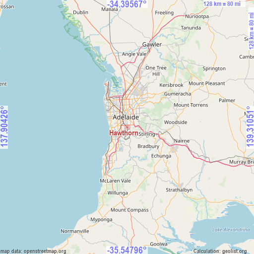
Hawthorn GPS coordinates[2]
34° 58' 25.824" South, 138° 36' 26.568" East
| Map corner | latitude | longitude |
|---|---|---|
| Upper-left | -34.39567°, | 137.90426° |
| Center: | -34.97384°, | 138.60738° |
| Lower-right: | -35.54796°, | 139.31051° |
| Map W x H: | 128.1×128.1 km | = 79.6×79.6mi |
| max Lat: | -10.58257° ⇑70.6% North |
| Hawthorn: | -34.97384° |
| min Lat: | ⇓29.4% South -43.31423° |
| min Long | Hawthorn | max Long |
| 113.53327° | 138.60738° | 153.61246° |
| W 18.8%⇐ | ⇒81.2% E |
Elevation
Elevation of Hawthorn is 73 m = 240 ft, and this is 49 m = 161 ft below average elevation for this country.
| Max E: |
1715 m = 5627 ft | 37% |
| Avg. | 122 m = 400 ft | |
| Hawthorn | 73 m = 240 ft | |
Min E: |
-2 m = -7 ft | 63% |
See also: Australia elevation on elevation.city.
Geographical zone
Hawthorn is located in South temperate zone (between Tropic of Capricorn and the Antarctic Circle). Distance of this Southern Tropic circle is 1282.8 km =797.1 mi to North.| Distance of | km | miles | from Hawthorn |
|---|---|---|---|
| Equator | 3888.7 | 2416.3 | to North |
| Tropic Capricorn | 1282.8 | 797.1 | to North |
| Antarctic Circle | 3512.4 | 2182.5 | to South |
| South Pole | 6118.3 | 3801.7 | to South |


Nearby cities:
15 places around Hawthorn: (largest is in red/bold)
• Clapham
1.9 km =1.2 mi,  196°
196°
• Colonel Light Gardens
1.7 km =1.1 mi,  213°
213°
• Cumberland Park
1.9 km =1.2 mi,  276°
276°
• Highgate
1.9 km =1.2 mi,  44°
44°
• Hyde Park
2.2 km =1.4 mi,  344°
344°
• Kings Park
1.9 km =1.2 mi,  306°
306°
• Lower Mitcham
0.4 km =0.2 mi, 210°
• Malvern
1.7 km =1.1 mi,  16°
16°
• Mitcham
1.4 km =0.9 mi,  113°
113°
• Netherby
1.7 km =1.1 mi,  76°
76°
• Panorama
2 km =1.2 mi, 200°
• Springfield
2.3 km =1.4 mi,  101°
101°
• Torrens Park
0.4 km =0.2 mi,  132°
132°
• Unley Park
1.1 km =0.7 mi,  1°
1°
• Westbourne Park
1.1 km =0.7 mi, 282°
Sources, notices
• [Note1] Compared only with cities in Australia existing in our database
• [Src1] Map data: © OpenStreetMap contributors (CC-BY-SA)
• [Src2] Other city data from geonames.org with taken over terms of usage.
• [Src3] Geographical zone / Annual Mean Temperature by Robert A. Rohde @ Wikipedia
