Meringandan West geodata
Meringandan West (Queensland) is a section of populated place; located in Australia in Australia/Brisbane (GMT+10) time zone. With population of 2,173 people, there are 2776 cities with bigger population in this country. Compared to other cities in Australia, 83.6% of cities are located further ↓South; 81.7% of cities are located further ←West and 94% of cities have lower elevation than Meringandan West. Note1


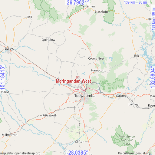
Meringandan West GPS coordinates[2]
27° 24' 58.032" South, 151° 53' 14.172" East
| Map corner | latitude | longitude |
|---|---|---|
| Upper-left | -26.79021°, | 151.18415° |
| Center: | -27.41612°, | 151.88727° |
| Lower-right: | -28.0385°, | 152.5904° |
| Map W x H: | 138.8×138.8 km | = 86.2×86.2mi |
| max Lat: | -10.58257° ⇑16.4% North |
| Meringandan West: | -27.41612° |
| min Lat: | ⇓83.6% South -43.31423° |
| min Long | Meringandan Wes | max Long |
| 113.53327° | 151.88727° | 153.61246° |
| W 81.7%⇐ | ⇒18.3% E |
Elevation
Elevation of Meringandan West is 541 m = 1775 ft, and this is 419 m = 1375 ft above average elevation for this country.
| Max E: |
1715 m = 5627 ft | 6% |
| Meringandan West | 541 m 1775 ft | |
| Avg. | 122 m = 400 ft | |
Min E: |
-2 m = -7 ft | 94% |
See also: Australia elevation on elevation.city.
Geographical zone
Meringandan West is located in South temperate zone (between Tropic of Capricorn and the Antarctic Circle). Distance of this Southern Tropic circle is 442.5 km =275 mi to North.| Distance of | km | miles | from Meringandan West |
|---|---|---|---|
| Equator | 3048.4 | 1894.2 | to North |
| Tropic Capricorn | 442.5 | 275 | to North |
| Antarctic Circle | 4352.8 | 2704.7 | to South |
| South Pole | 6958.7 | 4323.9 | to South |


Nearby cities:
15 places around Meringandan West: (largest is in red/bold)
• Blue Mountain Heights
12 km =7.5 mi,  145°
145°
• Cabarlah
11.3 km =7 mi,  99°
99°
• Cotswold Hills
11.8 km =7.3 mi,  176°
176°
• Cranley
11.5 km =7.1 mi,  162°
162°
• Goombungee
12.6 km =7.8 mi,  343°
343°
• Gowrie Junction
7.5 km =4.7 mi, 182°
• Harlaxton
15.2 km =9.4 mi, 148°
• Highfields
8.4 km =5.2 mi,  128°
128°
• Kingsthorpe
9.8 km =6.1 mi,  227°
227°
• Kleinton
6.5 km =4 mi,  107°
107°
• North Toowoomba
16 km =9.9 mi, 152°
• Rockville
14.3 km =8.9 mi, 159°
• Torrington
14 km =8.7 mi, 179°
• Wilsonton
14.4 km =8.9 mi,  168°
168°
• Wilsonton Heights
13.4 km =8.3 mi, 164°
Sources, notices
• [Note1] Compared only with cities in Australia existing in our database
• [Src1] Map data: © OpenStreetMap contributors (CC-BY-SA)
• [Src2] Other city data from geonames.org with taken over terms of usage.
• [Src3] Geographical zone / Annual Mean Temperature by Robert A. Rohde @ Wikipedia
