Goombungee geodata
Goombungee (Queensland) is a populated place; located in Australia in Australia/Brisbane (GMT+10) time zone. With population of 976 people, there are 3861 cities with bigger population in this country. Compared to other cities in Australia, 84.5% of cities are located further ↓South; 81.6% of cities are located further ←West and 93.5% of cities have lower elevation than Goombungee. Note1


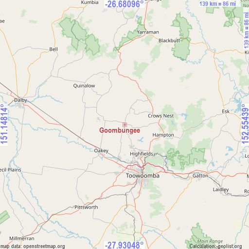
Goombungee GPS coordinates[2]
27° 18' 26.928" South, 151° 51' 4.536" East
| Map corner | latitude | longitude |
|---|---|---|
| Upper-left | -26.68096°, | 151.14814° |
| Center: | -27.30748°, | 151.85126° |
| Lower-right: | -27.93048°, | 152.55439° |
| Map W x H: | 138.9×138.9 km | = 86.3×86.3mi |
| max Lat: | -10.58257° ⇑15.5% North |
| Goombungee: | -27.30748° |
| min Lat: | ⇓84.5% South -43.31423° |
| min Long | Goombungee | max Long |
| 113.53327° | 151.85126° | 153.61246° |
| W 81.6%⇐ | ⇒18.4% E |
Elevation
Elevation of Goombungee is 505 m = 1657 ft, and this is 383 m = 1257 ft above average elevation for this country.
| Max E: |
1715 m = 5627 ft | 6.5% |
| Goombungee | 505 m 1657 ft | |
| Avg. | 122 m = 400 ft | |
Min E: |
-2 m = -7 ft | 93.5% |
See also: Australia elevation on elevation.city.
Geographical zone
Goombungee is located in South temperate zone (between Tropic of Capricorn and the Antarctic Circle). Distance of this Southern Tropic circle is 430.4 km =267.4 mi to North.| Distance of | km | miles | from Goombungee |
|---|---|---|---|
| Equator | 3036.3 | 1886.7 | to North |
| Tropic Capricorn | 430.4 | 267.4 | to North |
| Antarctic Circle | 4364.9 | 2712.2 | to South |
| South Pole | 6970.8 | 4331.5 | to South |


Nearby cities:
15 places around Goombungee: (largest is in red/bold)
• Blue Mountain Heights
24.3 km =15.1 mi,  154°
154°
• Cabarlah
20.3 km =12.6 mi,  133°
133°
• Cotswold Hills
24.3 km =15.1 mi,  169°
169°
• Cranley
24.1 km =15 mi,  162°
162°
• Crows Nest
20.5 km =12.7 mi,  75°
75°
• Gowrie Junction
19.8 km =12.3 mi, 170°
• Highfields
20.1 km =12.5 mi, 149°
• Kingsthorpe
19 km =11.8 mi,  191°
191°
• Kleinton
17.1 km =10.6 mi, 145°
• Meringandan West
12.6 km =7.8 mi, 163°
• Murphys Creek
26.6 km =16.5 mi, 130°
• Oakey
19 km =11.8 mi,  222°
222°
• Rockville
26.8 km =16.7 mi, 161°
• Torrington
26.4 km =16.4 mi, 172°
• Wilsonton Heights
26 km =16.2 mi, 163°
Sources, notices
• [Note1] Compared only with cities in Australia existing in our database
• [Src1] Map data: © OpenStreetMap contributors (CC-BY-SA)
• [Src2] Other city data from geonames.org with taken over terms of usage.
• [Src3] Geographical zone / Annual Mean Temperature by Robert A. Rohde @ Wikipedia
