Khodzhi-Gasan geodata
Khodzhi-Gasan (Baki) is a populated place; located in Azerbaijan in Asia/Baku (GMT+4) time zone. With population of 5,089 people, there are 109 cities with bigger population in this country. Compared to other cities in Azerbaijan, 52.4% of cities are located further ↑North; 85.9% of cities are located further ←West and 65.9% of cities have higher elevation than Khodzhi-Gasan. Note1


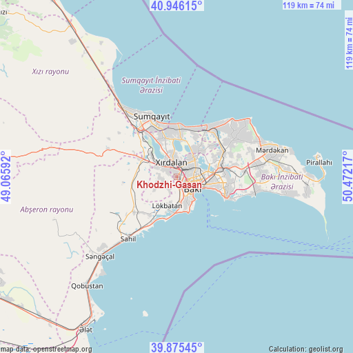
Khodzhi-Gasan GPS coordinates[2]
40° 24' 46.548" North, 49° 46' 8.544" East
| Map corner | latitude | longitude |
|---|---|---|
| Upper-left | 40.94615°, | 49.06592° |
| Center: | 40.41293°, | 49.76904° |
| Lower-right: | 39.87545°, | 50.47217° |
| Map W x H: | 119.1×119.1 km | = 74×74mi |
| max Lat: | 41.75259° ⇑52.4% North |
| Khodzhi-Gasan: | 40.41293° |
| min Lat: | ⇓47.6% South 38.45598° |
| min Long | Khodzhi-Gasan | max Long |
| 44.84846° | 49.76904° | 50.84003° |
| W 85.9%⇐ | ⇒14.1% E |
Elevation
Elevation of Khodzhi-Gasan is 30 m = 98 ft, and this is 353 m = 1158 ft below average elevation for this country.
| Max E: |
2211 m = 7254 ft | 65.9% |
| Avg. | 383 m = 1257 ft | |
| Khodzhi-Gasan | 30 m = 98 ft | |
Min E: |
-26 m = -85 ft | 34.1% |
See also: Azerbaijan elevation on elevation.city.
Geographical zone
Khodzhi-Gasan is located in North temperate zone (between Tropic of Cancer and the Arctic Circle). Distance of this Northern Tropic circle is 1887.6 km =1172.9 mi to South.| Distance of | km | miles | from Khodzhi-Gasan |
|---|---|---|---|
| North Pole | 5513.6 | 3426 | to North |
| Arctic Circle | 2907.7 | 1806.8 | to North |
| Tropic Cancer | 1887.6 | 1172.9 | to South |
| Equator | 4493.5 | 2792.1 | to South |


Nearby cities:
15 places around Khodzhi-Gasan: (largest is in red/bold)
• Badamdar
8.6 km =5.3 mi,  159°
159°
• Baku
11.1 km =6.9 mi,  110°
110°
• Bakıxanov
16.8 km =10.4 mi,  87°
87°
• Balakhani
13.9 km =8.6 mi,  66°
66°
• Bilajari
4.7 km =2.9 mi,  41°
41°
• Binagadi
7.7 km =4.8 mi, 40°
• Digah
12.6 km =7.8 mi,  45°
45°
• Gyuzdek
8.5 km =5.3 mi,  239°
239°
• Khirdalan
4.1 km =2.5 mi,  343°
343°
• Lökbatan
10.2 km =6.3 mi,  197°
197°
• Puta
15.9 km =9.9 mi,  215°
215°
• Qobu
4.8 km =3 mi,  259°
259°
• Sabunçu
15.5 km =9.6 mi,  77°
77°
• Saray
14.1 km =8.8 mi, 341°
• Zabrat
16.3 km =10.1 mi,  63°
63°
Sources, notices
• [Note1] Compared only with cities in Azerbaijan existing in our database
• [Src1] Map data: © OpenStreetMap contributors (CC-BY-SA)
• [Src2] Other city data from geonames.org with taken over terms of usage.
• [Src3] Geographical zone / Annual Mean Temperature by Robert A. Rohde @ Wikipedia
