Parvez Ali Hossain geodata
Parvez Ali Hossain (Dhaka) is a abandoned populated place; located in Bangladesh in Asia/Dhaka (GMT+6) time zone. With population of 6,000 people, there are 104 cities with bigger population in this country. Compared to other cities in Bangladesh, 50.4% of cities are located further ↑North; 52.1% of cities are located further ←West and 70.1% of cities have higher elevation than Parvez Ali Hossain. Note1


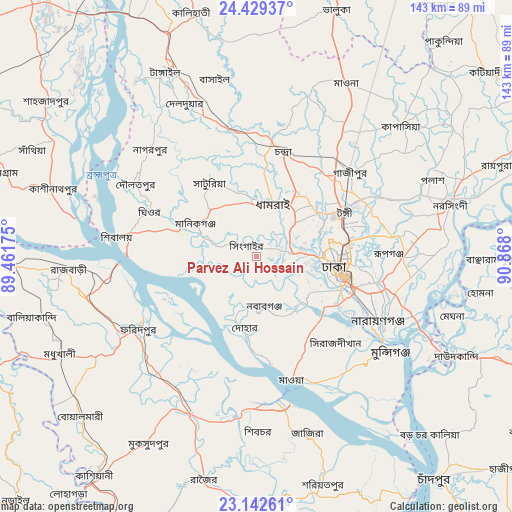
Parvez Ali Hossain GPS coordinates[2]
23° 47' 15.288" North, 90° 9' 53.532" East
| Map corner | latitude | longitude |
|---|---|---|
| Upper-left | 24.42937°, | 89.46175° |
| Center: | 23.78758°, | 90.16487° |
| Lower-right: | 23.14261°, | 90.868° |
| Map W x H: | 143.1×143.1 km | = 88.9×88.9mi |
| max Lat: | 26.33338° ⇑50.4% North |
| Parvez Ali Hossain: | 23.78758° |
| min Lat: | ⇓49.6% South 20.85829° |
| min Long | Parvez Ali Hoss | max Long |
| 88.15638° | 90.16487° | 92.29773° |
| W 52.1%⇐ | ⇒47.9% E |
Elevation
Elevation of Parvez Ali Hossain is 12 m = 39 ft, and this is 5.9 m = 19 ft below average elevation for this country.
| Max E: |
79 m = 259 ft | 70.1% |
| Avg. | 17.9 m = 59 ft | |
| Parvez Ali Hossain | 12 m = 39 ft | |
Min E: |
2 m = 7 ft | 29.9% |
See also: Bangladesh elevation on elevation.city.
Geographical zone
Parvez Ali Hossain is located in North temperate zone (between Tropic of Cancer and the Arctic Circle). Distance of this Northern Tropic circle is 39 km =24.2 mi to South.| Distance of | km | miles | from Parvez Ali Hossain |
|---|---|---|---|
| North Pole | 7362.1 | 4574.6 | to North |
| Arctic Circle | 4756.2 | 2955.4 | to North |
| Tropic Cancer | 39 | 24.2 | to South |
| Equator | 2644.9 | 1643.5 | to South |


Nearby cities:
15 places around Parvez Ali Hossain: (largest is in red/bold)
• Azimpur
23.3 km =14.5 mi,  105°
105°
• Char Golora
5.7 km =3.5 mi,  309°
309°
• Dhaka
26.1 km =16.2 mi, 109°
• Dohār
21.7 km =13.5 mi,  186°
186°
• Farīdpur
38.7 km =24 mi,  238°
238°
• Joymontop
0 km =0 mi,  336°
336°
• Khanbaniara
2 km =1.2 mi, 107°
• Mirzāpur
35.7 km =22.2 mi,  349°
349°
• Nāgarpur
41.9 km =26 mi,  315°
315°
• Nārāyanganj
39.5 km =24.5 mi,  119°
119°
• Paltan
26 km =16.2 mi,  102°
102°
• Parvez Ali
5.7 km =3.5 mi, 305°
• Ramnagar
1.6 km =1 mi,  135°
135°
• Sayani
0.6 km =0.4 mi,  50°
50°
• Tungi
26.8 km =16.7 mi,  64°
64°
Sources, notices
• [Note1] Compared only with cities in Bangladesh existing in our database
• [Src1] Map data: © OpenStreetMap contributors (CC-BY-SA)
• [Src2] Other city data from geonames.org with taken over terms of usage.
• [Src3] Geographical zone / Annual Mean Temperature by Robert A. Rohde @ Wikipedia
