Mirzāpur geodata
Mirzāpur (Dhaka) is a populated place; located in Bangladesh in Asia/Dhaka (GMT+6) time zone. With population of 41,137 people, there are 75 cities with bigger population in this country. Compared to other cities in Bangladesh, 62.4% of cities are located further ↓South; 52.1% of cities are located further →East and 50.4% of cities have lower elevation than Mirzāpur. Note1


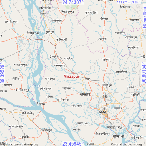
Mirzāpur GPS coordinates[2]
24° 6' 10.332" North, 90° 5' 54.276" East
| Map corner | latitude | longitude |
|---|---|---|
| Upper-left | 24.74307°, | 89.39529° |
| Center: | 24.10287°, | 90.09841° |
| Lower-right: | 23.45945°, | 90.80154° |
| Map W x H: | 142.7×142.7 km | = 88.7×88.7mi |
| max Lat: | 26.33338° ⇑37.6% North |
| Mirzāpur: | 24.10287° |
| min Lat: | ⇓62.4% South 20.85829° |
| min Long | Mirzāpur | max Long |
| 88.15638° | 90.09841° | 92.29773° |
| W 47.9%⇐ | ⇒52.1% E |
Elevation
Elevation of Mirzāpur is 15 m = 49 ft, and this is 2.9 m = 10 ft below average elevation for this country.
| Max E: |
79 m = 259 ft | 49.6% |
| Avg. | 17.9 m = 59 ft | |
| Mirzāpur | 15 m = 49 ft | |
Min E: |
2 m = 7 ft | 50.4% |
See also: Mirzāpur elevation on elevation.city.
Geographical zone
Mirzāpur is located in North temperate zone (between Tropic of Cancer and the Arctic Circle). Distance of this Northern Tropic circle is 74.1 km =46 mi to South.| Distance of | km | miles | from Mirzāpur |
|---|---|---|---|
| North Pole | 7327.1 | 4552.8 | to North |
| Arctic Circle | 4721.2 | 2933.6 | to North |
| Tropic Cancer | 74.1 | 46 | to South |
| Equator | 2680 | 1665.3 | to South |


Nearby cities:
15 places around Mirzāpur: (largest is in red/bold)
• Azimpur
50.7 km =31.5 mi,  144°
144°
• Bera
47.4 km =29.5 mi,  266°
266°
• Char Golora
31.5 km =19.6 mi,  175°
175°
• Joymontop
35.7 km =22.2 mi,  169°
169°
• Khanbaniara
36.7 km =22.8 mi, 166°
• Nāgarpur
23 km =14.3 mi,  257°
257°
• Paltan
51.9 km =32.2 mi, 141°
• Parvez Ali
31.8 km =19.8 mi, 176°
• Parvez Ali Hossain
35.7 km =22.2 mi, 169°
• Ramnagar
37.1 km =23.1 mi, 167°
• Sakhipur
25.2 km =15.7 mi,  16°
16°
• Sayani
35.4 km =22 mi, 168°
• Shāhzādpur
51.4 km =31.9 mi,  279°
279°
• Tungi
38.8 km =24.1 mi,  127°
127°
• Tāngāil
24.6 km =15.3 mi,  311°
311°
Sources, notices
• [Note1] Compared only with cities in Bangladesh existing in our database
• [Src1] Map data: © OpenStreetMap contributors (CC-BY-SA)
• [Src2] Other city data from geonames.org with taken over terms of usage.
• [Src3] Geographical zone / Annual Mean Temperature by Robert A. Rohde @ Wikipedia
