Vielsalm geodata
Vielsalm (Wallonia) is a populated place; located in Belgium in Europe/Brussels (GMT+2) time zone. With population of 7,291 people, there are 391 cities with bigger population in this country. Compared to other cities in Belgium, 89.5% of cities are located further ↑North; 96.9% of cities are located further ←West and 95.3% of cities have lower elevation than Vielsalm. Note1
Administrative division(s):
- Level 1: Wallonia
- Level 2: Province du Luxembourg
- Level 3: Arrondissement de Bastogne
- Level 4: Vielsalm


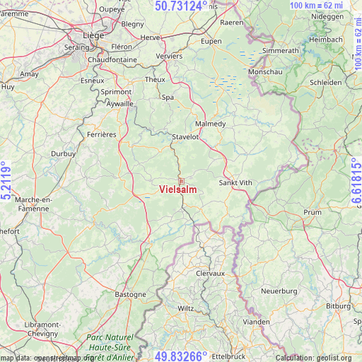
Vielsalm GPS coordinates[2]
50° 17' 2.652" North, 5° 54' 54.072" East
| Map corner | latitude | longitude |
|---|---|---|
| Upper-left | 50.73124°, | 5.2119° |
| Center: | 50.28407°, | 5.91502° |
| Lower-right: | 49.83266°, | 6.61815° |
| Map W x H: | 99.9×99.9 km | = 62.1×62.1mi |
| max Lat: | 51.46791° ⇑89.5% North |
| Vielsalm: | 50.28407° |
| min Lat: | ⇓10.5% South 49.53771° |
| min Long | Vielsalm | max Long |
| 2.59368° | 5.91502° | 6.25749° |
| W 96.9%⇐ | ⇒3.1% E |
Elevation
Elevation of Vielsalm is 367 m = 1204 ft, and this is 267.5 m = 878 ft above average elevation for this country.
| Max E: |
582 m = 1909 ft | 4.7% |
| Vielsalm | 367 m 1204 ft | |
| Avg. | 99.5 m = 326 ft | |
Min E: |
1 m = 3 ft | 95.3% |
See also: Belgium elevation on elevation.city.
Geographical zone
Vielsalm is located in North temperate zone (between Tropic of Cancer and the Arctic Circle). Distance of this North polar circle is 1810.1 km =1124.7 mi to North.| Distance of | km | miles | from Vielsalm |
|---|---|---|---|
| North Pole | 4416 | 2744 | to North |
| Arctic Circle | 1810.1 | 1124.7 | to North |
| Tropic Cancer | 2985.1 | 1854.9 | to South |
| Equator | 5591.1 | 3474.1 | to South |


Nearby cities:
15 places around Vielsalm: (largest is in red/bold)
• Amblève
19.7 km =12.2 mi,  66°
66°
• Butgenbach
26 km =16.2 mi,  52°
52°
• Ferrières
25.2 km =15.7 mi,  301°
301°
• Gouvy
11 km =6.8 mi,  171°
171°
• Houffalize
19.1 km =11.9 mi,  207°
207°
• Lierneux
8.7 km =5.4 mi,  270°
270°
• Malmédy
17.8 km =11.1 mi,  26°
26°
• Manhay
17 km =10.6 mi, 273°
• Saint-Vith
15.1 km =9.4 mi,  91°
91°
• Spa
22.5 km =14 mi,  351°
351°
• Stavelot
12.4 km =7.7 mi,  5°
5°
• Stoumont
15.6 km =9.7 mi,  330°
330°
• Trois-Ponts
10.2 km =6.3 mi,  342°
342°
• Waimes
20.2 km =12.6 mi,  43°
43°
• Érezée
25.4 km =15.8 mi, 272°
Sources, notices
• [Note1] Compared only with cities in Belgium existing in our database
• [Src1] Map data: © OpenStreetMap contributors (CC-BY-SA)
• [Src2] Other city data from geonames.org with taken over terms of usage.
• [Src3] Geographical zone / Annual Mean Temperature by Robert A. Rohde @ Wikipedia
