Binche geodata
Binche (Wallonia) is a populated place; located in Belgium in Europe/Brussels (GMT+2) time zone. With population of 32,030 people, there are 49 cities with bigger population in this country. Compared to other cities in Belgium, 82.9% of cities are located further ↑North; 69.9% of cities are located further →East and 63.5% of cities have lower elevation than Binche. Note1
Administrative division(s):
- Level 1: Wallonia
- Level 2: Province du Hainaut
- Level 3: Arrondissement de Thuin
- Level 4: Binche


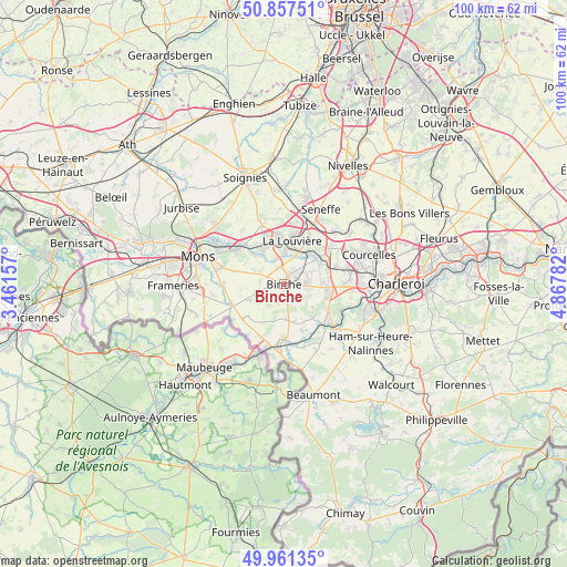
Binche GPS coordinates[2]
50° 24' 41.58" North, 4° 9' 52.884" East
| Map corner | latitude | longitude |
|---|---|---|
| Upper-left | 50.85751°, | 3.46157° |
| Center: | 50.41155°, | 4.16469° |
| Lower-right: | 49.96135°, | 4.86782° |
| Map W x H: | 99.6×99.6 km | = 61.9×61.9mi |
| max Lat: | 51.46791° ⇑82.9% North |
| Binche: | 50.41155° |
| min Lat: | ⇓17.1% South 49.53771° |
| min Long | Binche | max Long |
| 2.59368° | 4.16469° | 6.25749° |
| W 30.1%⇐ | ⇒69.9% E |
Elevation
Elevation of Binche is 92 m = 302 ft, and this is 7.5 m = 25 ft below average elevation for this country.
| Max E: |
582 m = 1909 ft | 36.5% |
| Avg. | 99.5 m = 326 ft | |
| Binche | 92 m = 302 ft | |
Min E: |
1 m = 3 ft | 63.5% |
See also: Belgium elevation on elevation.city.
Geographical zone
Binche is located in North temperate zone (between Tropic of Cancer and the Arctic Circle). Distance of this North polar circle is 1795.9 km =1115.9 mi to North.| Distance of | km | miles | from Binche |
|---|---|---|---|
| North Pole | 4401.8 | 2735.2 | to North |
| Arctic Circle | 1795.9 | 1115.9 | to North |
| Tropic Cancer | 2999.3 | 1863.7 | to South |
| Equator | 5605.2 | 3482.9 | to South |


Nearby cities:
15 places around Binche: (largest is in red/bold)
• Anderlues
7.6 km =4.7 mi,  93°
93°
• Chapelle-lez-Herlaimont
10.7 km =6.6 mi,  51°
51°
• Chasse Royale
15.3 km =9.5 mi,  277°
277°
• Courcelles
16 km =9.9 mi,  68°
68°
• Erquelinnes
12.2 km =7.6 mi,  198°
198°
• Estinnes-au-Val
4.2 km =2.6 mi,  267°
267°
• La Louvière
8.5 km =5.3 mi,  11°
11°
• Lobbes
9.8 km =6.1 mi,  132°
132°
• Manage
11.4 km =7.1 mi,  26°
26°
• Merbes-le-Château
9.7 km =6 mi,  179°
179°
• Mons
15.8 km =9.8 mi,  287°
287°
• Morlanwelz-Mariemont
7.5 km =4.7 mi, 49°
• Roeulx
10.9 km =6.8 mi,  339°
339°
• Seneffe
15 km =9.3 mi, 27°
• Thuin
11.8 km =7.3 mi, 133°
Sources, notices
• [Note1] Compared only with cities in Belgium existing in our database
• [Src1] Map data: © OpenStreetMap contributors (CC-BY-SA)
• [Src2] Other city data from geonames.org with taken over terms of usage.
• [Src3] Geographical zone / Annual Mean Temperature by Robert A. Rohde @ Wikipedia
