Walcourt geodata
Walcourt (Wallonia) is a populated place; located in Belgium in Europe/Brussels (GMT+2) time zone. With population of 17,501 people, there are 149 cities with bigger population in this country. Compared to other cities in Belgium, 90.3% of cities are located further ↑North; 58.1% of cities are located further →East and 81.8% of cities have lower elevation than Walcourt. Note1
Administrative division(s):
- Level 1: Wallonia
- Level 2: Province de Namur
- Level 3: Arrondissement de Philippeville
- Level 4: Walcourt


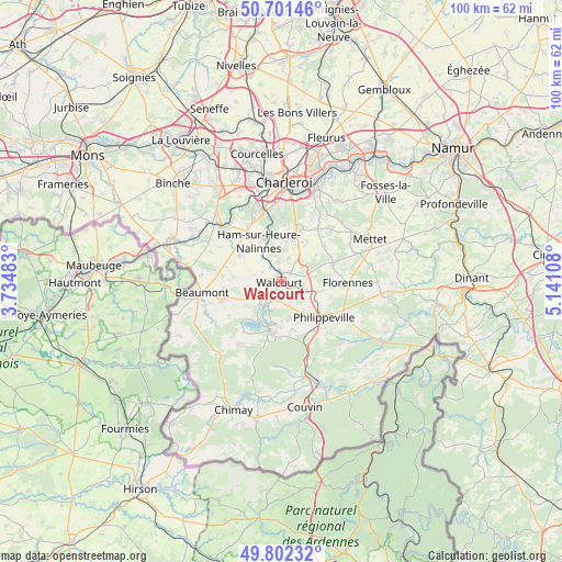
Walcourt GPS coordinates[2]
50° 15' 14.436" North, 4° 26' 16.656" East
| Map corner | latitude | longitude |
|---|---|---|
| Upper-left | 50.70146°, | 3.73483° |
| Center: | 50.25401°, | 4.43796° |
| Lower-right: | 49.80232°, | 5.14108° |
| Map W x H: | 100×100 km | = 62.1×62.1mi |
| max Lat: | 51.46791° ⇑90.3% North |
| Walcourt: | 50.25401° |
| min Lat: | ⇓9.7% South 49.53771° |
| min Long | Walcourt | max Long |
| 2.59368° | 4.43796° | 6.25749° |
| W 41.9%⇐ | ⇒58.1% E |
Elevation
Elevation of Walcourt is 187 m = 614 ft, and this is 87.5 m = 287 ft above average elevation for this country.
| Max E: |
582 m = 1909 ft | 18.2% |
| Walcourt | 187 m 614 ft | |
| Avg. | 99.5 m = 326 ft | |
Min E: |
1 m = 3 ft | 81.8% |
See also: Belgium elevation on elevation.city.
Geographical zone
Walcourt is located in North temperate zone (between Tropic of Cancer and the Arctic Circle). Distance of this North polar circle is 1813.5 km =1126.9 mi to North.| Distance of | km | miles | from Walcourt |
|---|---|---|---|
| North Pole | 4419.3 | 2746 | to North |
| Arctic Circle | 1813.5 | 1126.9 | to North |
| Tropic Cancer | 2981.8 | 1852.8 | to South |
| Equator | 5587.7 | 3472 | to South |


Nearby cities:
15 places around Walcourt: (largest is in red/bold)
• Aiseau
20.5 km =12.7 mi,  31°
31°
• Anderlues
20.7 km =12.9 mi,  325°
325°
• Beaumont
14.3 km =8.9 mi,  262°
262°
• Cerfontaine
9.5 km =5.9 mi,  191°
191°
• Charleroi
17.5 km =10.9 mi,  1°
1°
• Châtelet
17.8 km =11.1 mi,  21°
21°
• Farciennes
20.9 km =13 mi, 20°
• Florennes
12 km =7.5 mi,  91°
91°
• Froidchapelle
13.9 km =8.6 mi,  214°
214°
• Gerpinnes
11.3 km =7 mi, 34°
• La Bruyère
20 km =12.4 mi,  38°
38°
• Lobbes
16.3 km =10.1 mi,  312°
312°
• Mettet
17.6 km =10.9 mi,  64°
64°
• Philippeville
9.9 km =6.2 mi,  130°
130°
• Thuin
14.4 km =8.9 mi, 311°
Sources, notices
• [Note1] Compared only with cities in Belgium existing in our database
• [Src1] Map data: © OpenStreetMap contributors (CC-BY-SA)
• [Src2] Other city data from geonames.org with taken over terms of usage.
• [Src3] Geographical zone / Annual Mean Temperature by Robert A. Rohde @ Wikipedia
