Moerbeke geodata
Moerbeke (Flanders) is a populated place; located in Belgium in Europe/Brussels (GMT+2) time zone. With population of 5,855 people, there are 426 cities with bigger population in this country. Compared to other cities in Belgium, 88.3% of cities are located further ↓South; 76% of cities are located further →East and 100% of cities have higher elevation than Moerbeke. Note1
Administrative division(s):
- Level 1: Flanders
- Level 2: Provincie Oost-Vlaanderen
- Level 3: Arrondissement Gent
- Level 4: Moerbeke


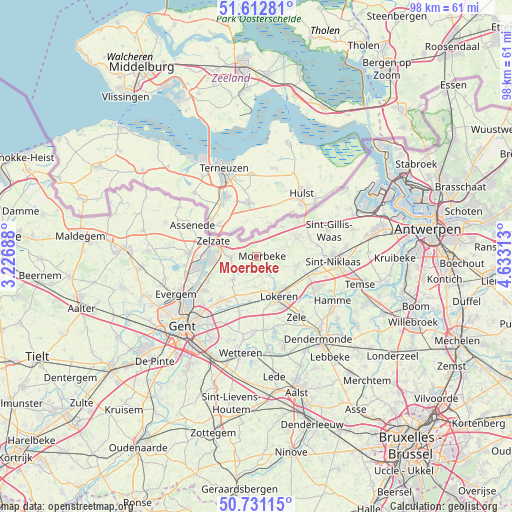
Moerbeke GPS coordinates[2]
51° 10' 26.724" North, 3° 55' 48.036" East
| Map corner | latitude | longitude |
|---|---|---|
| Upper-left | 51.61281°, | 3.22688° |
| Center: | 51.17409°, | 3.93001° |
| Lower-right: | 50.73115°, | 4.63313° |
| Map W x H: | 98×98 km | = 60.9×60.9mi |
| max Lat: | 51.46791° ⇑11.7% North |
| Moerbeke: | 51.17409° |
| min Lat: | ⇓88.3% South 49.53771° |
| min Long | Moerbeke | max Long |
| 2.59368° | 3.93001° | 6.25749° |
| W 24%⇐ | ⇒76% E |
Elevation
Elevation of Moerbeke is 1 m = 3 ft, and this is 98.5 m = 323 ft below average elevation for this country.
| Max E: |
582 m = 1909 ft | 100% |
| Avg. | 99.5 m = 326 ft | |
| Moerbeke | 1 m = 3 ft | |
Min E: |
1 m = 3 ft | 0% |
See also: Belgium elevation on elevation.city.
Geographical zone
Moerbeke is located in North temperate zone (between Tropic of Cancer and the Arctic Circle). Distance of this North polar circle is 1711.1 km =1063.2 mi to North.| Distance of | km | miles | from Moerbeke |
|---|---|---|---|
| North Pole | 4317 | 2682.5 | to North |
| Arctic Circle | 1711.1 | 1063.2 | to North |
| Tropic Cancer | 3084.1 | 1916.4 | to South |
| Equator | 5690 | 3535.6 | to South |


Nearby cities:
15 places around Moerbeke: (largest is in red/bold)
• Assenede
13.8 km =8.6 mi,  294°
294°
• Berlare
16.4 km =10.2 mi,  162°
162°
• Destelbergen
15.7 km =9.8 mi,  215°
215°
• Evergem
16.8 km =10.4 mi,  246°
246°
• Hamme
16.7 km =10.4 mi,  120°
120°
• Laarne
16.9 km =10.5 mi,  199°
199°
• Lochristi
11 km =6.8 mi, 218°
• Lokeren
9 km =5.6 mi,  150°
150°
• Sint-Gillis-Waas
14.4 km =8.9 mi,  69°
69°
• Sint-Niklaas
14.9 km =9.3 mi,  93°
93°
• Stekene
8.4 km =5.2 mi,  61°
61°
• Waasmunster
13.3 km =8.3 mi, 124°
• Wachtebeke
4.1 km =2.5 mi,  261°
261°
• Zele
14.3 km =8.9 mi, 147°
• Zelzate
8.7 km =5.4 mi,  281°
281°
Sources, notices
• [Note1] Compared only with cities in Belgium existing in our database
• [Src1] Map data: © OpenStreetMap contributors (CC-BY-SA)
• [Src2] Other city data from geonames.org with taken over terms of usage.
• [Src3] Geographical zone / Annual Mean Temperature by Robert A. Rohde @ Wikipedia
