Wachtebeke geodata
Wachtebeke (Flanders) is a populated place; located in Belgium in Europe/Brussels (GMT+2) time zone. With population of 6,911 people, there are 398 cities with bigger population in this country. Compared to other cities in Belgium, 87.7% of cities are located further ↓South; 77.4% of cities are located further →East and 93.3% of cities have higher elevation than Wachtebeke. Note1
Administrative division(s):
- Level 1: Flanders
- Level 2: Provincie Oost-Vlaanderen
- Level 3: Arrondissement Gent
- Level 4: Wachtebeke


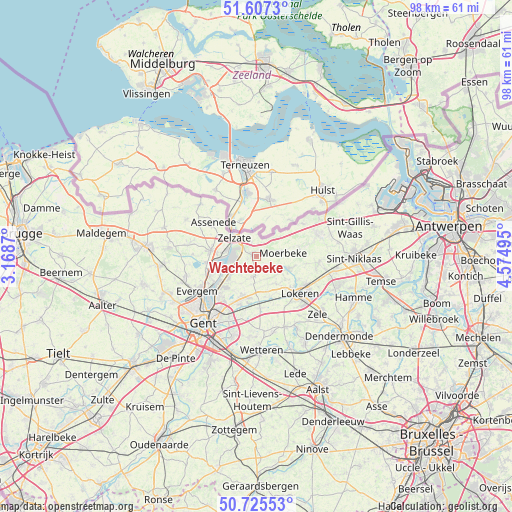
Wachtebeke GPS coordinates[2]
51° 10' 6.672" North, 3° 52' 18.588" East
| Map corner | latitude | longitude |
|---|---|---|
| Upper-left | 51.6073°, | 3.1687° |
| Center: | 51.16852°, | 3.87183° |
| Lower-right: | 50.72553°, | 4.57495° |
| Map W x H: | 98×98 km | = 60.9×60.9mi |
| max Lat: | 51.46791° ⇑12.3% North |
| Wachtebeke: | 51.16852° |
| min Lat: | ⇓87.7% South 49.53771° |
| min Long | Wachtebeke | max Long |
| 2.59368° | 3.87183° | 6.25749° |
| W 22.6%⇐ | ⇒77.4% E |
Elevation
Elevation of Wachtebeke is 7 m = 23 ft, and this is 92.5 m = 303 ft below average elevation for this country.
| Max E: |
582 m = 1909 ft | 93.3% |
| Avg. | 99.5 m = 326 ft | |
| Wachtebeke | 7 m = 23 ft | |
Min E: |
1 m = 3 ft | 6.7% |
See also: Belgium elevation on elevation.city.
Geographical zone
Wachtebeke is located in North temperate zone (between Tropic of Cancer and the Arctic Circle). Distance of this North polar circle is 1711.8 km =1063.7 mi to North.| Distance of | km | miles | from Wachtebeke |
|---|---|---|---|
| North Pole | 4317.7 | 2682.9 | to North |
| Arctic Circle | 1711.8 | 1063.7 | to North |
| Tropic Cancer | 3083.5 | 1916 | to South |
| Equator | 5689.4 | 3535.2 | to South |


Nearby cities:
15 places around Wachtebeke: (largest is in red/bold)
• Assenede
10.6 km =6.6 mi,  307°
307°
• Berlare
17.5 km =10.9 mi,  149°
149°
• Destelbergen
13.1 km =8.1 mi,  202°
202°
• Evergem
12.9 km =8 mi,  241°
241°
• Gent
17.1 km =10.6 mi,  219°
219°
• Laarne
15.4 km =9.6 mi,  185°
185°
• Ledeberg
17 km =10.6 mi,  211°
211°
• Lochristi
8.5 km =5.3 mi, 199°
• Lokeren
11.1 km =6.9 mi,  130°
130°
• Moerbeke
4.1 km =2.5 mi,  81°
81°
• Stekene
12.4 km =7.7 mi,  68°
68°
• Waasmunster
16.5 km =10.3 mi,  115°
115°
• Wetteren
18.2 km =11.3 mi,  177°
177°
• Zele
16.4 km =10.2 mi, 134°
• Zelzate
5 km =3.1 mi,  297°
297°
Sources, notices
• [Note1] Compared only with cities in Belgium existing in our database
• [Src1] Map data: © OpenStreetMap contributors (CC-BY-SA)
• [Src2] Other city data from geonames.org with taken over terms of usage.
• [Src3] Geographical zone / Annual Mean Temperature by Robert A. Rohde @ Wikipedia
