Chièvres geodata
Chièvres (Wallonia) is a populated place; located in Belgium in Europe/Brussels (GMT+2) time zone. With population of 6,045 people, there are 423 cities with bigger population in this country. Compared to other cities in Belgium, 70.2% of cities are located further ↑North; 79.8% of cities are located further →East and 51.1% of cities have lower elevation than Chièvres. Note1
Administrative division(s):
- Level 1: Wallonia
- Level 2: Province du Hainaut
- Level 3: Arrondissement d'Ath
- Level 4: Chièvres


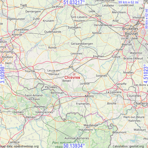
Chièvres GPS coordinates[2]
50° 35' 16.332" North, 3° 48' 25.596" East
| Map corner | latitude | longitude |
|---|---|---|
| Upper-left | 51.03217°, | 3.10398° |
| Center: | 50.58787°, | 3.80711° |
| Lower-right: | 50.13934°, | 4.51023° |
| Map W x H: | 99.3×99.3 km | = 61.7×61.7mi |
| max Lat: | 51.46791° ⇑70.2% North |
| Chièvres: | 50.58787° |
| min Lat: | ⇓29.8% South 49.53771° |
| min Long | Chièvres | max Long |
| 2.59368° | 3.80711° | 6.25749° |
| W 20.2%⇐ | ⇒79.8% E |
Elevation
Elevation of Chièvres is 52 m = 171 ft, and this is 47.5 m = 156 ft below average elevation for this country.
| Max E: |
582 m = 1909 ft | 48.9% |
| Avg. | 99.5 m = 326 ft | |
| Chièvres | 52 m = 171 ft | |
Min E: |
1 m = 3 ft | 51.1% |
See also: Belgium elevation on elevation.city.
Geographical zone
Chièvres is located in North temperate zone (between Tropic of Cancer and the Arctic Circle). Distance of this North polar circle is 1776.3 km =1103.7 mi to North.| Distance of | km | miles | from Chièvres |
|---|---|---|---|
| North Pole | 4382.2 | 2723 | to North |
| Arctic Circle | 1776.3 | 1103.7 | to North |
| Tropic Cancer | 3018.9 | 1875.9 | to South |
| Equator | 5624.8 | 3495.1 | to South |


Nearby cities:
15 places around Chièvres: (largest is in red/bold)
• Ath
5.1 km =3.2 mi,  336°
336°
• Beloeil
6.6 km =4.1 mi,  230°
230°
• Bernissart
16.8 km =10.4 mi,  221°
221°
• Boussu
17.1 km =10.6 mi,  183°
183°
• Brugelette
3.4 km =2.1 mi,  75°
75°
• Flobecq
17.3 km =10.7 mi, 343°
• Frasnes-lez-Anvaing
16.8 km =10.4 mi,  313°
313°
• Frasnes-lez-Buissenal
15.9 km =9.9 mi,  304°
304°
• Jurbise
9.6 km =6 mi,  131°
131°
• Lens
7.4 km =4.6 mi,  117°
117°
• Lessines
13.8 km =8.6 mi,  8°
8°
• Péruwelz
17.5 km =10.9 mi,  239°
239°
• Quaregnon
16.9 km =10.5 mi,  165°
165°
• Saint-Ghislain
15.6 km =9.7 mi, 176°
• Silly
10.7 km =6.6 mi,  50°
50°
Sources, notices
• [Note1] Compared only with cities in Belgium existing in our database
• [Src1] Map data: © OpenStreetMap contributors (CC-BY-SA)
• [Src2] Other city data from geonames.org with taken over terms of usage.
• [Src3] Geographical zone / Annual Mean Temperature by Robert A. Rohde @ Wikipedia
