Chastre-Villeroux-Blanmont geodata
Chastre-Villeroux-Blanmont (Wallonia) is a populated place; located in Belgium in Europe/Brussels (GMT+2) time zone. With population of 6,243 people, there are 418 cities with bigger population in this country. Compared to other cities in Belgium, 68.2% of cities are located further ↑North; 53.2% of cities are located further ←West and 72.4% of cities have lower elevation than Chastre-Villeroux-Blanmont. Note1
Administrative division(s):
- Level 1: Wallonia
- Level 2: Province du Brabant Wallon
- Level 3: Arrondissement de Nivelles
- Level 4: Chastre
Current local time in Chastre-Villeroux-Blanmont:
09:45 AM, ThursdayDifference from your time zone: hours


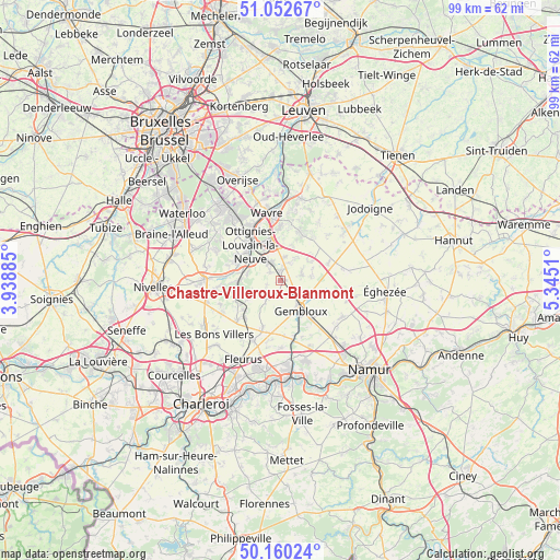
Chastre-Villeroux-Blanmont GPS coordinates[2]
50° 36' 30.852" North, 4° 38' 31.128" East
| Map corner | latitude | longitude |
|---|---|---|
| Upper-left | 51.05267°, | 3.93885° |
| Center: | 50.60857°, | 4.64198° |
| Lower-right: | 50.16024°, | 5.3451° |
| Map W x H: | 99.2×99.2 km | = 61.6×61.6mi |
| max Lat: | 51.46791° ⇑68.2% North |
| Chastre-Villeroux-Blanmont: | 50.60857° |
| min Lat: | ⇓31.8% South 49.53771° |
| min Long | Chastre-Villero | max Long |
| 2.59368° | 4.64198° | 6.25749° |
| W 53.2%⇐ | ⇒46.8% E |
Elevation
Elevation of Chastre-Villeroux-Blanmont is 133 m = 436 ft, and this is 33.5 m = 110 ft above average elevation for this country.
| Max E: |
582 m = 1909 ft | 27.6% |
| Chastre-Villeroux-Blanmont | 133 m 436 ft | |
| Avg. | 99.5 m = 326 ft | |
Min E: |
1 m = 3 ft | 72.4% |
See also: Belgium elevation on elevation.city.
Geographical zone
Chastre-Villeroux-Blanmont is located in North temperate zone (between Tropic of Cancer and the Arctic Circle). Distance of this North polar circle is 1774 km =1102.3 mi to North.| Distance of | km | miles | from Chastre-Villeroux-Blanmont |
|---|---|---|---|
| North Pole | 4379.9 | 2721.5 | to North |
| Arctic Circle | 1774 | 1102.3 | to North |
| Tropic Cancer | 3021.2 | 1877.3 | to South |
| Equator | 5627.1 | 3496.5 | to South |


Nearby cities:
15 places around Chastre-Villeroux-Blanmont: (largest is in red/bold)
• Basse Lasne
14.3 km =8.9 mi,  312°
312°
• Chastre
1 km =0.6 mi,  212°
212°
• Chaumont-Gistoux
9.5 km =5.9 mi,  36°
36°
• Court-Saint-Étienne
5.9 km =3.7 mi,  298°
298°
• Gembloux
6.6 km =4.1 mi,  142°
142°
• Genappe
13.4 km =8.3 mi,  271°
271°
• Louvain-la-Neuve
6.9 km =4.3 mi,  343°
343°
• Mont-Saint-Guibert
3.6 km =2.2 mi,  322°
322°
• Ottignies
8.2 km =5.1 mi, 319°
• Perwez
12.2 km =7.6 mi,  81°
81°
• Rixensart
14.2 km =8.8 mi, 324°
• Sombreffe
9.3 km =5.8 mi,  198°
198°
• Villers-la-Ville
10 km =6.2 mi,  242°
242°
• Walhain-Saint-Paul
4.4 km =2.7 mi,  63°
63°
• Wavre
12.4 km =7.7 mi,  346°
346°
Sources, notices
• [Note1] Compared only with cities in Belgium existing in our database
• [Src1] Map data: © OpenStreetMap contributors (CC-BY-SA)
• [Src2] Other city data from geonames.org with taken over terms of usage.
• [Src3] Geographical zone / Annual Mean Temperature by Robert A. Rohde @ Wikipedia
