Stara Zagora geodata
Stara Zagora is a seat of a first-order administrative division; located in Bulgaria in Europe/Sofia (GMT+3) time zone. With population of 143,431 people, there are 5 cities with bigger population in this country. Compared to other cities in Bulgaria, 68.3% of cities are located further ↑North; 60.7% of cities are located further ←West and 55% of cities have higher elevation than Stara Zagora. Note1


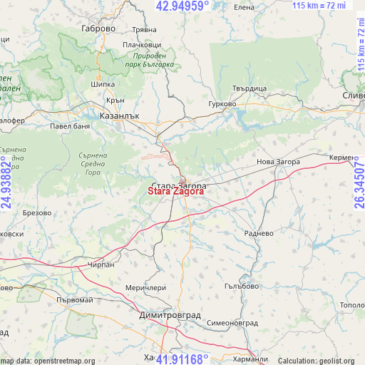
Stara Zagora GPS coordinates[2]
42° 25' 58.008" North, 25° 38' 30.984" East
| Map corner | latitude | longitude |
|---|---|---|
| Upper-left | 42.94959°, | 24.93882° |
| Center: | 42.43278°, | 25.64194° |
| Lower-right: | 41.91168°, | 26.34507° |
| Map W x H: | 115.4×115.4 km | = 71.7×71.7mi |
| max Lat: | 44.16214° ⇑68.3% North |
| Stara Zagora: | 42.43278° |
| min Lat: | ⇓31.7% South 41.32715° |
| min Long | Stara Zagora | max Long |
| 22.52139° | 25.64194° | 28.53429° |
| W 60.7%⇐ | ⇒39.3% E |
Elevation
Elevation of Stara Zagora is 205 m = 673 ft, and this is 111.6 m = 366 ft below average elevation for this country.
| Max E: |
1221 m = 4006 ft | 55% |
| Avg. | 316.6 m = 1039 ft | |
| Stara Zagora | 205 m = 673 ft | |
Min E: |
1 m = 3 ft | 45% |
See also: Stara Zagora elevation on elevation.city.
Geographical zone
Stara Zagora is located in North temperate zone (between Tropic of Cancer and the Arctic Circle). Distance of this Northern Tropic circle is 2112.2 km =1312.5 mi to South.| Distance of | km | miles | from Stara Zagora |
|---|---|---|---|
| North Pole | 5289 | 3286.4 | to North |
| Arctic Circle | 2683.1 | 1667.2 | to North |
| Tropic Cancer | 2112.2 | 1312.5 | to South |
| Equator | 4718.1 | 2931.7 | to South |


Nearby cities:
15 places around Stara Zagora: (largest is in red/bold)
• Bratya Daskalovi
37.9 km =23.5 mi,  247°
247°
• Chirpan
36.2 km =22.5 mi,  224°
224°
• Dimitrovgrad
42.7 km =26.5 mi,  184°
184°
• Elkhovo
18 km =11.2 mi, 252°
• Gurkovo
29.1 km =18.1 mi,  26°
26°
• Gŭlŭbovo
37.4 km =23.2 mi,  152°
152°
• Kazanlak
28.5 km =17.7 mi,  315°
315°
• Maglizh
20.1 km =12.5 mi,  337°
337°
• Nikolaevo
25.8 km =16 mi, 30°
• Nova Zagora
31.2 km =19.4 mi,  79°
79°
• Opan
24.5 km =15.2 mi,  168°
168°
• Pavel Banya
40.7 km =25.3 mi,  297°
297°
• Radnevo
28.1 km =17.5 mi,  121°
121°
• Shipka
40.4 km =25.1 mi, 321°
• Tvarditsa
36.5 km =22.7 mi,  35°
35°
Sources, notices
• [Note1] Compared only with cities in Bulgaria existing in our database
• [Src1] Map data: © OpenStreetMap contributors (CC-BY-SA)
• [Src2] Other city data from geonames.org with taken over terms of usage.
• [Src3] Geographical zone / Annual Mean Temperature by Robert A. Rohde @ Wikipedia
