Villa Serrano geodata
Villa Serrano (Chuquisaca) is a seat of a third-order administrative division; located in Bolivia in America/La_Paz (GMT-4) time zone. In our database, there are 117 cities with bigger population. Compared to other cities in Bolivia, 72.7% of cities are located further ↑North; 68.3% of cities are located further ←West and 53.4% of cities have higher elevation than Villa Serrano. Note1
Administrative division(s):
- Level 1: Chuquisaca
- Level 2: Provincia Belisario Boeto
- Level 3: Villa Serrano


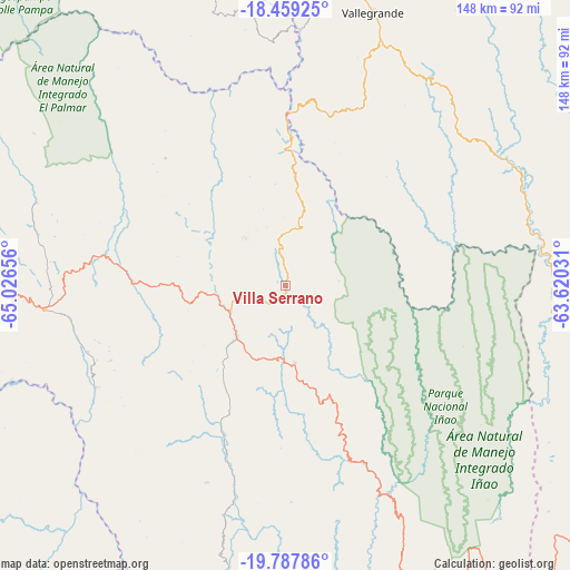
Villa Serrano GPS coordinates[2]
19° 7' 29.604" South, 64° 19' 24.348" West
| Map corner | latitude | longitude |
|---|---|---|
| Upper-left | -18.45925°, | -65.02656° |
| Center: | -19.12489°, | -64.32343° |
| Lower-right: | -19.78786°, | -63.62031° |
| Map W x H: | 147.7×147.7 km | = 91.8×91.8mi |
| max Lat: | -9.71828° ⇑72.7% North |
| Villa Serrano: | -19.12489° |
| min Lat: | ⇓27.3% South -22.73206° |
| min Long | Villa Serrano | max Long |
| -69.14843° | -64.32343° | -57.76667° |
| W 68.3%⇐ | ⇒31.7% E |
Elevation
Elevation of Villa Serrano is 2115 m = 6939 ft, and this is 103.7 m = 340 ft above average elevation for this country.
| Max E: |
4732 m = 15525 ft | 53.4% |
| Villa Serrano | 2115 m 6939 ft | |
| Avg. | 2011.3 m = 6599 ft | |
Min E: |
92 m = 302 ft | 46.6% |
See also: Bolivia elevation on elevation.city.
Geographical zone
Villa Serrano is located in South Torrid zone (between Equator and Tropic of Capricorn). Distance of this Southern Tropic circle is 479.4 km =297.9 mi to South.| Distance of | km | miles | from Villa Serrano |
|---|---|---|---|
| Equator | 2126.5 | 1321.3 | to North |
| Tropic Capricorn | 479.4 | 297.9 | to South |
| Antarctic Circle | 5274.7 | 3277.5 | to South |
| South Pole | 7880.6 | 4896.8 | to South |


Nearby cities:
15 places around Villa Serrano: (largest is in red/bold)
• Chuqui Chuqui
85.3 km =53 mi,  293°
293°
• Huata
98.1 km =61 mi,  277°
277°
• Mojocoya
50.8 km =31.6 mi,  322°
322°
• Mojotoro
81.5 km =50.6 mi, 286°
• Monteagudo
84.4 km =52.4 mi,  152°
152°
• Padilla
20.6 km =12.8 mi,  173°
173°
• Presto
68.3 km =42.4 mi, 288°
• Pulqui
94.6 km =58.8 mi,  262°
262°
• San Pedro
57.7 km =35.9 mi,  198°
198°
• Sotomayor
74.9 km =46.5 mi,  251°
251°
• Tarabuco
62.5 km =38.8 mi, 264°
• Tomina
23 km =14.3 mi, 253°
• Vallegrande
74.3 km =46.2 mi,  17°
17°
• Yamparáez
84.3 km =52.4 mi,  265°
265°
• Yotala
98.9 km =61.5 mi, 267°
Sources, notices
• [Note1] Compared only with cities in Bolivia existing in our database
• [Src1] Map data: © OpenStreetMap contributors (CC-BY-SA)
• [Src2] Other city data from geonames.org with taken over terms of usage.
• [Src3] Geographical zone / Annual Mean Temperature by Robert A. Rohde @ Wikipedia
