Padilla geodata
Padilla (Chuquisaca) is a populated place; located in Bolivia in America/La_Paz (GMT-4) time zone. With population of 2,920 people, there are 88 cities with bigger population in this country. Compared to other cities in Bolivia, 77% of cities are located further ↑North; 68.9% of cities are located further ←West and 54% of cities have higher elevation than Padilla. Note1


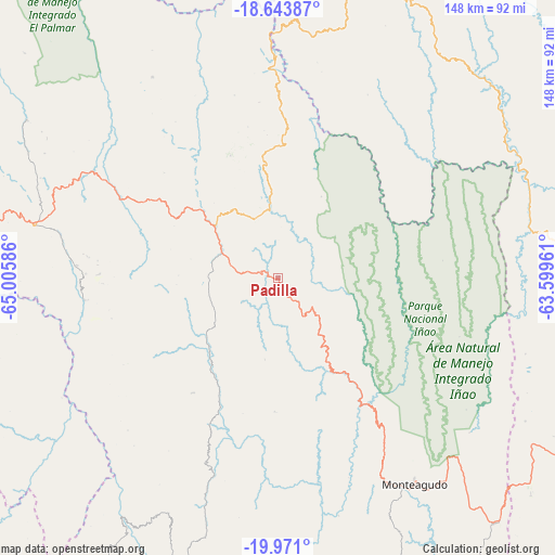
Padilla GPS coordinates[2]
19° 18' 31.608" South, 64° 18' 9.828" West
| Map corner | latitude | longitude |
|---|---|---|
| Upper-left | -18.64387°, | -65.00586° |
| Center: | -19.30878°, | -64.30273° |
| Lower-right: | -19.971°, | -63.59961° |
| Map W x H: | 147.6×147.6 km | = 91.7×91.7mi |
| max Lat: | -9.71828° ⇑77% North |
| Padilla: | -19.30878° |
| min Lat: | ⇓23% South -22.73206° |
| min Long | Padilla | max Long |
| -69.14843° | -64.30273° | -57.76667° |
| W 68.9%⇐ | ⇒31.1% E |
Elevation
Elevation of Padilla is 2091 m = 6860 ft, and this is 79.7 m = 261 ft above average elevation for this country.
| Max E: |
4732 m = 15525 ft | 54% |
| Padilla | 2091 m 6860 ft | |
| Avg. | 2011.3 m = 6599 ft | |
Min E: |
92 m = 302 ft | 46% |
See also: Bolivia elevation on elevation.city.
Geographical zone
Padilla is located in South Torrid zone (between Equator and Tropic of Capricorn). Distance of this Southern Tropic circle is 459 km =285.2 mi to South.| Distance of | km | miles | from Padilla |
|---|---|---|---|
| Equator | 2146.9 | 1334 | to North |
| Tropic Capricorn | 459 | 285.2 | to South |
| Antarctic Circle | 5254.2 | 3264.8 | to South |
| South Pole | 7860.1 | 4884 | to South |


Nearby cities:
15 places around Padilla: (largest is in red/bold)
• Azurduy
89.4 km =55.6 mi,  187°
187°
• Chuqui Chuqui
97.2 km =60.4 mi,  304°
304°
• Mojocoya
69.1 km =42.9 mi,  331°
331°
• Mojotoro
91.3 km =56.7 mi, 298°
• Monteagudo
65.7 km =40.8 mi,  146°
146°
• Presto
79.1 km =49.2 mi, 302°
• Pulqui
96.3 km =59.8 mi,  274°
274°
• San Pedro
40 km =24.9 mi,  211°
211°
• Sapirangui
88.2 km =54.8 mi,  141°
141°
• Sotomayor
73.2 km =45.5 mi, 267°
• Tarabuco
65.8 km =40.9 mi,  282°
282°
• Tomina
27.9 km =17.3 mi, 299°
• Vallegrande
93.4 km =58 mi,  12°
12°
• Villa Serrano
20.6 km =12.8 mi,  353°
353°
• Yamparáez
87.2 km =54.2 mi, 278°
Sources, notices
• [Note1] Compared only with cities in Bolivia existing in our database
• [Src1] Map data: © OpenStreetMap contributors (CC-BY-SA)
• [Src2] Other city data from geonames.org with taken over terms of usage.
• [Src3] Geographical zone / Annual Mean Temperature by Robert A. Rohde @ Wikipedia
