Sapirangui geodata
Sapirangui (Chuquisaca) is a seat of a fourth-order administrative division; located in Bolivia in America/La_Paz (GMT-4) time zone. In our database, there are 117 cities with bigger population. Compared to other cities in Bolivia, 81.4% of cities are located further ↑North; 73.9% of cities are located further ←West and 62.1% of cities have higher elevation than Sapirangui. Note1
Administrative division(s):
- Level 1: Chuquisaca
- Level 2: Provincia Luis Calvo
- Level 3: Villa Vaca Guzmán (Muyupampa)
- Level 4: Sapirangui


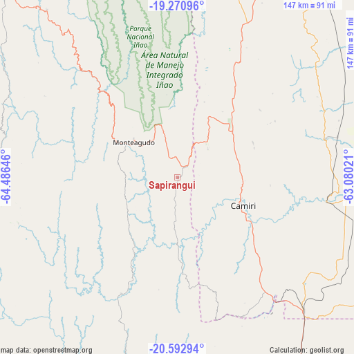
Sapirangui GPS coordinates[2]
19° 55' 59.988" South, 63° 46' 59.988" West
| Map corner | latitude | longitude |
|---|---|---|
| Upper-left | -19.27096°, | -64.48646° |
| Center: | -19.93333°, | -63.78333° |
| Lower-right: | -20.59294°, | -63.08021° |
| Map W x H: | 147×147 km | = 91.3×91.3mi |
| max Lat: | -9.71828° ⇑81.4% North |
| Sapirangui: | -19.93333° |
| min Lat: | ⇓18.6% South -22.73206° |
| min Long | Sapirangui | max Long |
| -69.14843° | -63.78333° | -57.76667° |
| W 73.9%⇐ | ⇒26.1% E |
Elevation
Elevation of Sapirangui is 1202 m = 3944 ft, and this is 809.3 m = 2655 ft below average elevation for this country.
| Max E: |
4732 m = 15525 ft | 62.1% |
| Avg. | 2011.3 m = 6599 ft | |
| Sapirangui | 1202 m = 3944 ft | |
Min E: |
92 m = 302 ft | 37.9% |
See also: Bolivia elevation on elevation.city.
Geographical zone
Sapirangui is located in South Torrid zone (between Equator and Tropic of Capricorn). Distance of this Southern Tropic circle is 389.5 km =242 mi to South.| Distance of | km | miles | from Sapirangui |
|---|---|---|---|
| Equator | 2216.4 | 1377.2 | to North |
| Tropic Capricorn | 389.5 | 242 | to South |
| Antarctic Circle | 5184.8 | 3221.7 | to South |
| South Pole | 7790.7 | 4840.9 | to South |


Nearby cities:
15 places around Sapirangui: (largest is in red/bold)
• Abapó
124.2 km =77.2 mi,  19°
19°
• Azurduy
68.6 km =42.6 mi,  253°
253°
• Boyuibe
76.3 km =47.4 mi,  136°
136°
• Camatindi
122.3 km =76 mi,  162°
162°
• Camiri
30.1 km =18.7 mi,  112°
112°
• Carandayti
117.6 km =73.1 mi, 140°
• Charagua
63.1 km =39.2 mi,  75°
75°
• Huajlaya
109 km =67.7 mi,  227°
227°
• Monteagudo
23.3 km =14.5 mi,  309°
309°
• Padilla
88.2 km =54.8 mi,  321°
321°
• Rosario del Ingre
73.3 km =45.5 mi,  189°
189°
• San Pedro
82.8 km =51.4 mi,  295°
295°
• Santa Elena
124.8 km =77.5 mi,  236°
236°
• Tomina
114.6 km =71.2 mi, 316°
• Villa Serrano
106.2 km =66 mi,  327°
327°
Sources, notices
• [Note1] Compared only with cities in Bolivia existing in our database
• [Src1] Map data: © OpenStreetMap contributors (CC-BY-SA)
• [Src2] Other city data from geonames.org with taken over terms of usage.
• [Src3] Geographical zone / Annual Mean Temperature by Robert A. Rohde @ Wikipedia
