Soure geodata
Soure (Pará) is a populated place; located in Brazil in America/Belem (GMT-3) time zone. With population of 18,212 people, there are 1030 cities with bigger population in this country. Compared to other cities in Brazil, 99.6% of cities are located further ↓South; 67.5% of cities are located further →East and 90.4% of cities have higher elevation than Soure. Note1


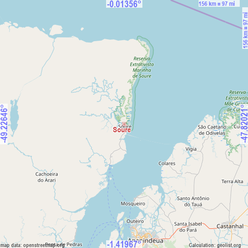
Soure GPS coordinates[2]
0° 43' 0.012" South, 48° 31' 23.988" West
| Map corner | latitude | longitude |
|---|---|---|
| Upper-left | -0.01356°, | -49.22646° |
| Center: | -0.71667°, | -48.52333° |
| Lower-right: | -1.41967°, | -47.82021° |
| Map W x H: | 156.3×156.3 km | = 97.1×97.1mi |
| max Lat: | 2.81972° ⇑0.4% North |
| Soure: | -0.71667° |
| min Lat: | ⇓99.6% South -33.69111° |
| min Long | Soure | max Long |
| -72.89583° | -48.52333° | -32.41083° |
| W 32.5%⇐ | ⇒67.5% E |
Elevation
Elevation of Soure is 17 m = 56 ft, and this is 363.9 m = 1194 ft below average elevation for this country.
| Max E: |
1603 m = 5259 ft | 90.4% |
| Avg. | 380.9 m = 1250 ft | |
| Soure | 17 m = 56 ft | |
Min E: |
0 m = 0 ft | 9.6% |
See also: Brazil elevation on elevation.city.
Geographical zone
Soure is located in South Torrid zone (between Equator and Tropic of Capricorn). Distance of Equator is 79.7 km =49.5 mi to North.| Distance of | km | miles | from Soure |
|---|---|---|---|
| Equator | 79.7 | 49.5 | to North |
| Tropic Capricorn | 2526.2 | 1569.7 | to South |
| Antarctic Circle | 7321.5 | 4549.4 | to South |
| South Pole | 9927.4 | 6168.6 | to South |


Nearby cities:
15 places around Soure: (largest is in red/bold)
• Abaetetuba
118.3 km =73.5 mi,  199°
199°
• Ananindeua
74.1 km =46 mi,  166°
166°
• Barcarena
88.5 km =55 mi,  187°
187°
• Belém
82.2 km =51.1 mi,  178°
178°
• Benevides
78.1 km =48.5 mi,  156°
156°
• Bujaru
103.5 km =64.3 mi,  149°
149°
• Castanhal
92.3 km =57.4 mi,  134°
134°
• Curuçá
75.1 km =46.7 mi,  91°
91°
• Igarapé Açu
110.4 km =68.6 mi,  114°
114°
• Maracanã
119 km =73.9 mi, 92°
• Marapanim
91.6 km =56.9 mi, 90°
• Muaná
118.7 km =73.8 mi,  220°
220°
• Santo Antônio do Tauá
65.3 km =40.6 mi,  137°
137°
• São Caetano de Odivelas
56.1 km =34.9 mi, 93°
• Vigia
45.3 km =28.1 mi, 110°
Sources, notices
• [Note1] Compared only with cities in Brazil existing in our database
• [Src1] Map data: © OpenStreetMap contributors (CC-BY-SA)
• [Src2] Other city data from geonames.org with taken over terms of usage.
• [Src3] Geographical zone / Annual Mean Temperature by Robert A. Rohde @ Wikipedia
