Santana do Mundaú geodata
Santana do Mundaú (Alagoas) is a populated place; located in Brazil in America/Maceio (GMT-3) time zone. With population of 6,439 people, there are 1859 cities with bigger population in this country. Compared to other cities in Brazil, 70.6% of cities are located further ↓South; 91.9% of cities are located further ←West and 58.4% of cities have higher elevation than Santana do Mundaú. Note1


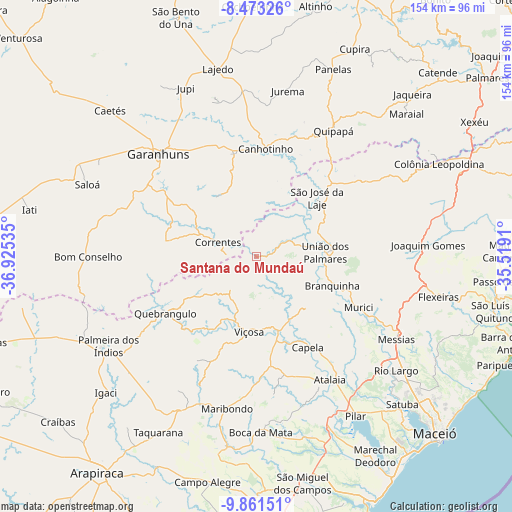
Santana do Mundaú GPS coordinates[2]
9° 10' 5.016" South, 36° 13' 19.992" West
| Map corner | latitude | longitude |
|---|---|---|
| Upper-left | -8.47326°, | -36.92535° |
| Center: | -9.16806°, | -36.22222° |
| Lower-right: | -9.86151°, | -35.5191° |
| Map W x H: | 154.4×154.4 km | = 95.9×95.9mi |
| max Lat: | 2.81972° ⇑29.4% North |
| Santana do Mundaú: | -9.16806° |
| min Lat: | ⇓70.6% South -33.69111° |
| min Long | Santana do Mund | max Long |
| -72.89583° | -36.22222° | -32.41083° |
| W 91.9%⇐ | ⇒8.1% E |
Elevation
Elevation of Santana do Mundaú is 229 m = 751 ft, and this is 151.9 m = 498 ft below average elevation for this country.
| Max E: |
1603 m = 5259 ft | 58.4% |
| Avg. | 380.9 m = 1250 ft | |
| Santana do Mundaú | 229 m = 751 ft | |
Min E: |
0 m = 0 ft | 41.6% |
See also: Brazil elevation on elevation.city.
Geographical zone
Santana do Mundaú is located in South Torrid zone (between Equator and Tropic of Capricorn). Distance of Equator is 1019.4 km =633.4 mi to North.| Distance of | km | miles | from Santana do Mundaú |
|---|---|---|---|
| Equator | 1019.4 | 633.4 | to North |
| Tropic Capricorn | 1586.5 | 985.8 | to South |
| Antarctic Circle | 6381.8 | 3965.5 | to South |
| South Pole | 8987.7 | 5584.7 | to South |


Nearby cities:
15 places around Santana do Mundaú: (largest is in red/bold)
• Atalaia
43.1 km =26.8 mi,  149°
149°
• Canhotinho
32 km =19.9 mi,  6°
6°
• Capela
31.2 km =19.4 mi, 148°
• Flexeiras
48.6 km =30.2 mi,  93°
93°
• Garanhuns
44.2 km =27.5 mi,  315°
315°
• Ibateguara
37.9 km =23.5 mi,  54°
54°
• Maribondo
46.4 km =28.8 mi,  191°
191°
• Messias
48.1 km =29.9 mi,  119°
119°
• Murici
34.3 km =21.3 mi, 116°
• Quebrangulo
32.1 km =19.9 mi,  238°
238°
• Quipapá
44.3 km =27.5 mi,  31°
31°
• São José da Laje
25.2 km =15.7 mi, 45°
• São João
36.2 km =22.5 mi,  333°
333°
• União dos Palmares
20.9 km =13 mi, 88°
• Viçosa
22.7 km =14.1 mi, 185°
Sources, notices
• [Note1] Compared only with cities in Brazil existing in our database
• [Src1] Map data: © OpenStreetMap contributors (CC-BY-SA)
• [Src2] Other city data from geonames.org with taken over terms of usage.
• [Src3] Geographical zone / Annual Mean Temperature by Robert A. Rohde @ Wikipedia
