Canhotinho geodata
Canhotinho (Pernambuco) is a populated place; located in Brazil in America/Recife (GMT-3) time zone. With population of 12,074 people, there are 1470 cities with bigger population in this country. Compared to other cities in Brazil, 71.6% of cities are located further ↓South; 92% of cities are located further ←West and 65.5% of cities have lower elevation than Canhotinho. Note1


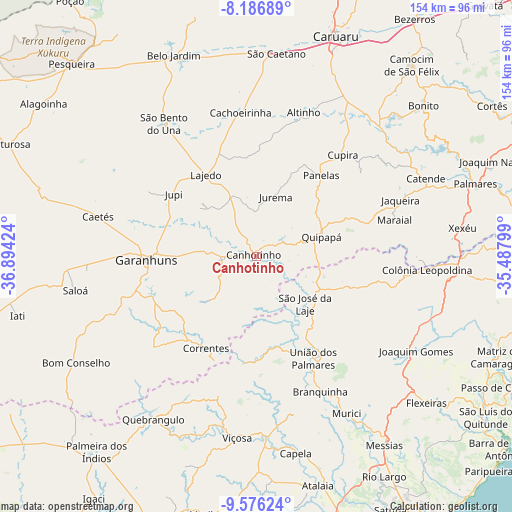
Canhotinho GPS coordinates[2]
8° 52' 55.992" South, 36° 11' 27.996" West
| Map corner | latitude | longitude |
|---|---|---|
| Upper-left | -8.18689°, | -36.89424° |
| Center: | -8.88222°, | -36.19111° |
| Lower-right: | -9.57624°, | -35.48799° |
| Map W x H: | 154.5×154.5 km | = 96×96mi |
| max Lat: | 2.81972° ⇑28.4% North |
| Canhotinho: | -8.88222° |
| min Lat: | ⇓71.6% South -33.69111° |
| min Long | Canhotinho | max Long |
| -72.89583° | -36.19111° | -32.41083° |
| W 92%⇐ | ⇒8% E |
Elevation
Elevation of Canhotinho is 529 m = 1736 ft, and this is 148.1 m = 486 ft above average elevation for this country.
| Max E: |
1603 m = 5259 ft | 34.5% |
| Canhotinho | 529 m 1736 ft | |
| Avg. | 380.9 m = 1250 ft | |
Min E: |
0 m = 0 ft | 65.5% |
See also: Brazil elevation on elevation.city.
Geographical zone
Canhotinho is located in South Torrid zone (between Equator and Tropic of Capricorn). Distance of Equator is 987.6 km =613.7 mi to North.| Distance of | km | miles | from Canhotinho |
|---|---|---|---|
| Equator | 987.6 | 613.7 | to North |
| Tropic Capricorn | 1618.3 | 1005.6 | to South |
| Antarctic Circle | 6413.6 | 3985.2 | to South |
| South Pole | 9019.5 | 5604.5 | to South |


Nearby cities:
15 places around Canhotinho: (largest is in red/bold)
• Altinho
46 km =28.6 mi,  18°
18°
• Cachoeirinha
44.3 km =27.5 mi,  354°
354°
• Caetés
48.9 km =30.4 mi,  284°
284°
• Capoeiras
50.6 km =31.4 mi,  288°
288°
• Colônia Leopoldina
51.3 km =31.9 mi,  93°
93°
• Cupira
39.7 km =24.7 mi,  41°
41°
• Garanhuns
34.2 km =21.3 mi,  270°
270°
• Ibateguara
29.4 km =18.3 mi,  109°
109°
• Lajedo
28.1 km =17.5 mi,  329°
329°
• Maraial
43.4 km =27 mi,  75°
75°
• Quipapá
20.6 km =12.8 mi,  72°
72°
• Santana do Mundaú
32 km =19.9 mi,  186°
186°
• São José da Laje
20.3 km =12.6 mi,  134°
134°
• São João
19.3 km =12 mi, 272°
• União dos Palmares
35.8 km =22.2 mi,  150°
150°
Sources, notices
• [Note1] Compared only with cities in Brazil existing in our database
• [Src1] Map data: © OpenStreetMap contributors (CC-BY-SA)
• [Src2] Other city data from geonames.org with taken over terms of usage.
• [Src3] Geographical zone / Annual Mean Temperature by Robert A. Rohde @ Wikipedia
