Portel geodata
Portel (Pará) is a populated place; located in Brazil in America/Belem (GMT-3) time zone. With population of 21,315 people, there are 895 cities with bigger population in this country. Compared to other cities in Brazil, 97.5% of cities are located further ↓South; 81.6% of cities are located further →East and 93.2% of cities have higher elevation than Portel. Note1


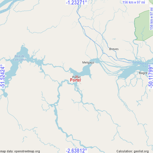
Portel GPS coordinates[2]
1° 56' 8.016" South, 50° 49' 15.996" West
| Map corner | latitude | longitude |
|---|---|---|
| Upper-left | -1.23271°, | -51.52424° |
| Center: | -1.93556°, | -50.82111° |
| Lower-right: | -2.63812°, | -50.11799° |
| Map W x H: | 156.3×156.3 km | = 97.1×97.1mi |
| max Lat: | 2.81972° ⇑2.5% North |
| Portel: | -1.93556° |
| min Lat: | ⇓97.5% South -33.69111° |
| min Long | Portel | max Long |
| -72.89583° | -50.82111° | -32.41083° |
| W 18.4%⇐ | ⇒81.6% E |
Elevation
Elevation of Portel is 12 m = 39 ft, and this is 368.9 m = 1210 ft below average elevation for this country.
| Max E: |
1603 m = 5259 ft | 93.2% |
| Avg. | 380.9 m = 1250 ft | |
| Portel | 12 m = 39 ft | |
Min E: |
0 m = 0 ft | 6.8% |
See also: Brazil elevation on elevation.city.
Geographical zone
Portel is located in South Torrid zone (between Equator and Tropic of Capricorn). Distance of Equator is 215.2 km =133.7 mi to North.| Distance of | km | miles | from Portel |
|---|---|---|---|
| Equator | 215.2 | 133.7 | to North |
| Tropic Capricorn | 2390.7 | 1485.5 | to South |
| Antarctic Circle | 7186 | 4465.2 | to South |
| South Pole | 9791.8 | 6084.3 | to South |


Nearby cities:
15 places around Portel: (largest is in red/bold)
• Afuá
203.6 km =126.5 mi,  13°
13°
• Almeirim
201 km =124.9 mi,  283°
283°
• Altamira
208.7 km =129.7 mi,  227°
227°
• Baião
159.2 km =98.9 mi,  126°
126°
• Breves
47.2 km =29.3 mi,  53°
53°
• Cametá
151.2 km =94 mi,  103°
103°
• Gurupá
108.5 km =67.4 mi,  302°
302°
• Igarapé Miri
206.9 km =128.6 mi,  91°
91°
• Limoeiro do Ajuru
160.1 km =99.5 mi, 88°
• Mazagão
209 km =129.9 mi,  345°
345°
• Mocajuba
162.8 km =101.2 mi,  116°
116°
• Muaná
184 km =114.3 mi,  75°
75°
• Oeiras do Pará
107.7 km =66.9 mi, 93°
• Porto de Moz
158.9 km =98.7 mi, 277°
• Senador José Porfírio
145.4 km =90.3 mi,  239°
239°
Sources, notices
• [Note1] Compared only with cities in Brazil existing in our database
• [Src1] Map data: © OpenStreetMap contributors (CC-BY-SA)
• [Src2] Other city data from geonames.org with taken over terms of usage.
• [Src3] Geographical zone / Annual Mean Temperature by Robert A. Rohde @ Wikipedia
