Mazagão geodata
Mazagão (Amapá) is a populated place; located in Brazil in America/Belem (GMT-3) time zone. With population of 6,500 people, there are 1855 cities with bigger population in this country. Compared to other cities in Brazil, 99.9% of cities are located further ↓South; 84.4% of cities are located further →East and 91.4% of cities have higher elevation than Mazagão. Note1


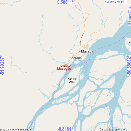
Mazagão GPS coordinates[2]
0° 6' 54" South, 51° 17' 21.984" West
| Map corner | latitude | longitude |
|---|---|---|
| Upper-left | 0.58811°, | -51.99257° |
| Center: | -0.115°, | -51.28944° |
| Lower-right: | -0.8181°, | -50.58632° |
| Map W x H: | 156.4×156.4 km | = 97.2×97.2mi |
| max Lat: | 2.81972° ⇑0.1% North |
| Mazagão: | -0.115° |
| min Lat: | ⇓99.9% South -33.69111° |
| min Long | Mazagão | max Long |
| -72.89583° | -51.28944° | -32.41083° |
| W 15.6%⇐ | ⇒84.4% E |
Elevation
Elevation of Mazagão is 15 m = 49 ft, and this is 365.9 m = 1200 ft below average elevation for this country.
| Max E: |
1603 m = 5259 ft | 91.4% |
| Avg. | 380.9 m = 1250 ft | |
| Mazagão | 15 m = 49 ft | |
Min E: |
0 m = 0 ft | 8.6% |
See also: Brazil elevation on elevation.city.
Geographical zone
Mazagão is located in South Torrid zone (between Equator and Tropic of Capricorn). Distance of Equator is 12.8 km =8 mi to North.| Distance of | km | miles | from Mazagão |
|---|---|---|---|
| Equator | 12.8 | 8 | to North |
| Tropic Capricorn | 2593.1 | 1611.3 | to South |
| Antarctic Circle | 7388.4 | 4590.9 | to South |
| South Pole | 9994.3 | 6210.2 | to South |


Nearby cities:
15 places around Mazagão: (largest is in red/bold)
• Afuá
100.5 km =62.4 mi,  92°
92°
• Almeirim
212.5 km =132 mi,  222°
222°
• Breves
196.1 km =121.9 mi,  152°
152°
• Cametá
309.5 km =192.3 mi,  139°
139°
• Gurupá
148.6 km =92.3 mi,  195°
195°
• Limoeiro do Ajuru
290.2 km =180.3 mi,  133°
133°
• Macapá
30.1 km =18.7 mi,  55°
55°
• Muaná
278.9 km =173.3 mi,  124°
124°
• Oeiras do Pará
263.7 km =163.9 mi, 142°
• Portel
209 km =129.9 mi,  165°
165°
• Porto de Moz
210 km =130.5 mi,  210°
210°
• Prainha
307.3 km =190.9 mi,  232°
232°
• Santana
13.5 km =8.4 mi, 62°
• Senador José Porfírio
285 km =177.1 mi, 195°
• Tucumã
138 km =85.7 mi, 93°
Sources, notices
• [Note1] Compared only with cities in Brazil existing in our database
• [Src1] Map data: © OpenStreetMap contributors (CC-BY-SA)
• [Src2] Other city data from geonames.org with taken over terms of usage.
• [Src3] Geographical zone / Annual Mean Temperature by Robert A. Rohde @ Wikipedia
