Penalva geodata
Penalva (Maranhão) is a populated place; located in Brazil in America/Fortaleza (GMT-3) time zone. With population of 17,186 people, there are 1084 cities with bigger population in this country. Compared to other cities in Brazil, 94.4% of cities are located further ↓South; 50.7% of cities are located further ←West and 90.4% of cities have higher elevation than Penalva. Note1


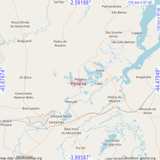
Penalva GPS coordinates[2]
3° 17' 39.012" South, 45° 10' 24.996" West
| Map corner | latitude | longitude |
|---|---|---|
| Upper-left | -2.59198°, | -45.87674° |
| Center: | -3.29417°, | -45.17361° |
| Lower-right: | -3.99587°, | -44.47049° |
| Map W x H: | 156.1×156.1 km | = 97×97mi |
| max Lat: | 2.81972° ⇑5.6% North |
| Penalva: | -3.29417° |
| min Lat: | ⇓94.4% South -33.69111° |
| min Long | Penalva | max Long |
| -72.89583° | -45.17361° | -32.41083° |
| W 50.7%⇐ | ⇒49.3% E |
Elevation
Elevation of Penalva is 17 m = 56 ft, and this is 363.9 m = 1194 ft below average elevation for this country.
| Max E: |
1603 m = 5259 ft | 90.4% |
| Avg. | 380.9 m = 1250 ft | |
| Penalva | 17 m = 56 ft | |
Min E: |
0 m = 0 ft | 9.6% |
See also: Brazil elevation on elevation.city.
Geographical zone
Penalva is located in South Torrid zone (between Equator and Tropic of Capricorn). Distance of Equator is 366.3 km =227.6 mi to North.| Distance of | km | miles | from Penalva |
|---|---|---|---|
| Equator | 366.3 | 227.6 | to North |
| Tropic Capricorn | 2239.6 | 1391.6 | to South |
| Antarctic Circle | 7034.9 | 4371.3 | to South |
| South Pole | 9640.8 | 5990.5 | to South |


Nearby cities:
15 places around Penalva: (largest is in red/bold)
• Anajatuba
61.6 km =38.3 mi,  86°
86°
• Araguanã
66.5 km =41.3 mi,  305°
305°
• Arari
47.1 km =29.3 mi,  112°
112°
• Matinha
26.6 km =16.5 mi,  35°
35°
• Monção
23.6 km =14.7 mi,  201°
201°
• Nova Olina do Marnhao
76.9 km =47.8 mi, 310°
• Pindaré Mirim
39.7 km =24.7 mi,  208°
208°
• Pinheiro
86.5 km =53.7 mi,  6°
6°
• Pio XII
59.9 km =37.2 mi,  177°
177°
• Santa Inês
47.3 km =29.4 mi, 208°
• São Bento
77.2 km =48 mi,  30°
30°
• São João Batista
55.5 km =34.5 mi,  47°
47°
• Viana
20.6 km =12.8 mi,  66°
66°
• Vitorino Freire
83.5 km =51.9 mi, 184°
• Vitória do Mearim
38.5 km =23.9 mi,  119°
119°
Sources, notices
• [Note1] Compared only with cities in Brazil existing in our database
• [Src1] Map data: © OpenStreetMap contributors (CC-BY-SA)
• [Src2] Other city data from geonames.org with taken over terms of usage.
• [Src3] Geographical zone / Annual Mean Temperature by Robert A. Rohde @ Wikipedia
