Curaçá geodata
Curaçá (Bahia) is a populated place; located in Brazil in America/Bahia (GMT-3) time zone. With population of 11,858 people, there are 1493 cities with bigger population in this country. Compared to other cities in Brazil, 71.2% of cities are located further ↓South; 75.6% of cities are located further ←West and 50.6% of cities have lower elevation than Curaçá. Note1


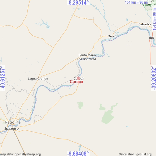
Curaçá GPS coordinates[2]
8° 59' 25.008" South, 39° 54' 33.984" West
| Map corner | latitude | longitude |
|---|---|---|
| Upper-left | -8.29514°, | -40.61257° |
| Center: | -8.99028°, | -39.90944° |
| Lower-right: | -9.68408°, | -39.20632° |
| Map W x H: | 154.4×154.4 km | = 95.9×95.9mi |
| max Lat: | 2.81972° ⇑28.8% North |
| Curaçá: | -8.99028° |
| min Lat: | ⇓71.2% South -33.69111° |
| min Long | Curaçá | max Long |
| -72.89583° | -39.90944° | -32.41083° |
| W 75.6%⇐ | ⇒24.4% E |
Elevation
Elevation of Curaçá is 359 m = 1178 ft, and this is 21.9 m = 72 ft below average elevation for this country.
| Max E: |
1603 m = 5259 ft | 49.4% |
| Avg. | 380.9 m = 1250 ft | |
| Curaçá | 359 m = 1178 ft | |
Min E: |
0 m = 0 ft | 50.6% |
See also: Brazil elevation on elevation.city.
Geographical zone
Curaçá is located in South Torrid zone (between Equator and Tropic of Capricorn). Distance of Equator is 999.6 km =621.1 mi to North.| Distance of | km | miles | from Curaçá |
|---|---|---|---|
| Equator | 999.6 | 621.1 | to North |
| Tropic Capricorn | 1606.3 | 998.1 | to South |
| Antarctic Circle | 6401.5 | 3977.7 | to South |
| South Pole | 9007.4 | 5596.9 | to South |


Nearby cities:
15 places around Curaçá: (largest is in red/bold)
• Araripina
170.1 km =105.7 mi,  337°
337°
• Belém de São Francisco
106.9 km =66.4 mi,  75°
75°
• Cabrobó
84.5 km =52.5 mi,  51°
51°
• Exu
165.6 km =102.9 mi,  7°
7°
• Floresta
153.6 km =95.4 mi,  73°
73°
• Ipubi
151.1 km =93.9 mi,  349°
349°
• Jaguarari
145.1 km =90.2 mi,  192°
192°
• Ouricuri
124.6 km =77.4 mi, 351°
• Parnamirim
106.5 km =66.2 mi,  19°
19°
• Petrolina
79.2 km =49.2 mi,  235°
235°
• Salgueiro
133.9 km =83.2 mi,  40°
40°
• Santa Maria da Boa Vista
22.3 km =13.9 mi, 24°
• Senhor do Bonfim
166.4 km =103.4 mi, 190°
• Trindade
142.2 km =88.4 mi, 343°
• Uauá
105.6 km =65.6 mi,  153°
153°
Sources, notices
• [Note1] Compared only with cities in Brazil existing in our database
• [Src1] Map data: © OpenStreetMap contributors (CC-BY-SA)
• [Src2] Other city data from geonames.org with taken over terms of usage.
• [Src3] Geographical zone / Annual Mean Temperature by Robert A. Rohde @ Wikipedia
