Carutapera geodata
Carutapera (Maranhão) is a populated place; located in Brazil in America/Fortaleza (GMT-3) time zone. With population of 12,819 people, there are 1385 cities with bigger population in this country. Compared to other cities in Brazil, 99% of cities are located further ↓South; 52.4% of cities are located further →East and 100% of cities have higher elevation than Carutapera. Note1


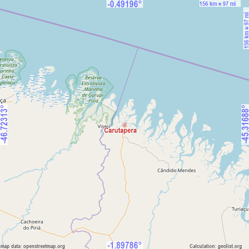
Carutapera GPS coordinates[2]
1° 11' 42" South, 46° 1' 12" West
| Map corner | latitude | longitude |
|---|---|---|
| Upper-left | -0.49196°, | -46.72313° |
| Center: | -1.195°, | -46.02° |
| Lower-right: | -1.89786°, | -45.31688° |
| Map W x H: | 156.3×156.3 km | = 97.1×97.1mi |
| max Lat: | 2.81972° ⇑1% North |
| Carutapera: | -1.195° |
| min Lat: | ⇓99% South -33.69111° |
| min Long | Carutapera | max Long |
| -72.89583° | -46.02° | -32.41083° |
| W 47.6%⇐ | ⇒52.4% E |
Elevation
Elevation of Carutapera is 0 m = 0 ft, and this is 380.9 m = 1250 ft below average elevation for this country.
| Max E: |
1603 m = 5259 ft | 100% |
| Avg. | 380.9 m = 1250 ft | |
| Carutapera | 0 m = 0 ft | |
Min E: |
0 m = 0 ft | 0% |
See also: Brazil elevation on elevation.city.
Geographical zone
Carutapera is located in South Torrid zone (between Equator and Tropic of Capricorn). Distance of Equator is 132.9 km =82.6 mi to North.| Distance of | km | miles | from Carutapera |
|---|---|---|---|
| Equator | 132.9 | 82.6 | to North |
| Tropic Capricorn | 2473 | 1536.7 | to South |
| Antarctic Circle | 7268.3 | 4516.3 | to South |
| South Pole | 9874.2 | 6135.5 | to South |


Nearby cities:
15 places around Carutapera: (largest is in red/bold)
• Augusto Corrêa
71 km =44.1 mi,  285°
285°
• Bragança
84.4 km =52.4 mi,  280°
280°
• Capanema
129 km =80.2 mi,  269°
269°
• Capitão Poço
130.8 km =81.3 mi,  242°
242°
• Cururupu
146.1 km =90.8 mi,  118°
118°
• Cândido Mendes
43.8 km =27.2 mi,  129°
129°
• Maracanã
166.4 km =103.4 mi, 286°
• Maracaçumé
94.5 km =58.7 mi,  175°
175°
• Ourém
128 km =79.5 mi,  251°
251°
• Salinópolis
162 km =100.7 mi, 293°
• Santa Helena
140.3 km =87.2 mi,  145°
145°
• São João de Pirabas
136.9 km =85.1 mi, 289°
• São Miguel do Guamá
169.6 km =105.4 mi, 253°
• Turiaçu
88.9 km =55.2 mi, 125°
• Viseu
13.3 km =8.3 mi, 269°
Sources, notices
• [Note1] Compared only with cities in Brazil existing in our database
• [Src1] Map data: © OpenStreetMap contributors (CC-BY-SA)
• [Src2] Other city data from geonames.org with taken over terms of usage.
• [Src3] Geographical zone / Annual Mean Temperature by Robert A. Rohde @ Wikipedia
