Brejo Santo geodata
Brejo Santo (Ceará) is a populated place; located in Brazil in America/Fortaleza (GMT-3) time zone. With population of 27,384 people, there are 722 cities with bigger population in this country. Compared to other cities in Brazil, 77.7% of cities are located further ↓South; 80.3% of cities are located further ←West and 52.7% of cities have lower elevation than Brejo Santo. Note1


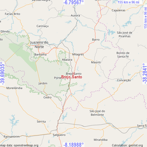
Brejo Santo GPS coordinates[2]
7° 29' 35.988" South, 38° 59' 13.992" West
| Map corner | latitude | longitude |
|---|---|---|
| Upper-left | -6.79567°, | -39.69035° |
| Center: | -7.49333°, | -38.98722° |
| Lower-right: | -8.18988°, | -38.2841° |
| Map W x H: | 155×155 km | = 96.3×96.3mi |
| max Lat: | 2.81972° ⇑22.3% North |
| Brejo Santo: | -7.49333° |
| min Lat: | ⇓77.7% South -33.69111° |
| min Long | Brejo Santo | max Long |
| -72.89583° | -38.98722° | -32.41083° |
| W 80.3%⇐ | ⇒19.7% E |
Elevation
Elevation of Brejo Santo is 386 m = 1266 ft, and this is 5.1 m = 17 ft above average elevation for this country.
| Max E: |
1603 m = 5259 ft | 47.3% |
| Brejo Santo | 386 m 1266 ft | |
| Avg. | 380.9 m = 1250 ft | |
Min E: |
0 m = 0 ft | 52.7% |
See also: Brazil elevation on elevation.city.
Geographical zone
Brejo Santo is located in South Torrid zone (between Equator and Tropic of Capricorn). Distance of Equator is 833.2 km =517.7 mi to North.| Distance of | km | miles | from Brejo Santo |
|---|---|---|---|
| Equator | 833.2 | 517.7 | to North |
| Tropic Capricorn | 1772.7 | 1101.5 | to South |
| Antarctic Circle | 6568 | 4081.2 | to South |
| South Pole | 9173.9 | 5700.4 | to South |


Nearby cities:
15 places around Brejo Santo: (largest is in red/bold)
• Aurora
61.3 km =38.1 mi,  2°
2°
• Barbalha
40.4 km =25.1 mi,  300°
300°
• Barro
87.4 km =54.3 mi,  8°
8°
• Cajazeiras
82.3 km =51.1 mi,  35°
35°
• Caririaçu
59.9 km =37.2 mi,  326°
326°
• Crato
54.8 km =34.1 mi, 301°
• Exu
81.3 km =50.5 mi,  268°
268°
• Farias Brito
89.4 km =55.6 mi,  314°
314°
• Juazeiro do Norte
47.7 km =29.6 mi, 310°
• Lavras da Mangabeira
82.3 km =51.1 mi, 1°
• Milagres
20.5 km =12.7 mi, 12°
• Missão Velha
32.1 km =19.9 mi, 327°
• Salgueiro
66.2 km =41.1 mi,  192°
192°
• São José de Piranhas
67.7 km =42.1 mi,  52°
52°
• São José do Belmonte
48 km =29.8 mi,  148°
148°
Sources, notices
• [Note1] Compared only with cities in Brazil existing in our database
• [Src1] Map data: © OpenStreetMap contributors (CC-BY-SA)
• [Src2] Other city data from geonames.org with taken over terms of usage.
• [Src3] Geographical zone / Annual Mean Temperature by Robert A. Rohde @ Wikipedia
