Missão Velha geodata
Missão Velha (Ceará) is a populated place; located in Brazil in America/Fortaleza (GMT-3) time zone. With population of 13,106 people, there are 1362 cities with bigger population in this country. Compared to other cities in Brazil, 79% of cities are located further ↓South; 79.3% of cities are located further ←West and 51% of cities have lower elevation than Missão Velha. Note1


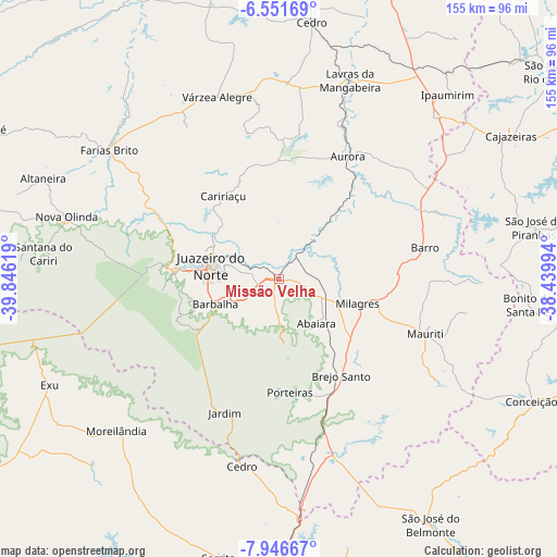
Missão Velha GPS coordinates[2]
7° 14' 58.992" South, 39° 8' 35.016" West
| Map corner | latitude | longitude |
|---|---|---|
| Upper-left | -6.55169°, | -39.84619° |
| Center: | -7.24972°, | -39.14306° |
| Lower-right: | -7.94667°, | -38.43994° |
| Map W x H: | 155.1×155.1 km | = 96.4×96.4mi |
| max Lat: | 2.81972° ⇑21% North |
| Missão Velha: | -7.24972° |
| min Lat: | ⇓79% South -33.69111° |
| min Long | Missão Velha | max Long |
| -72.89583° | -39.14306° | -32.41083° |
| W 79.3%⇐ | ⇒20.7% E |
Elevation
Elevation of Missão Velha is 364 m = 1194 ft, and this is 16.9 m = 55 ft below average elevation for this country.
| Max E: |
1603 m = 5259 ft | 49% |
| Avg. | 380.9 m = 1250 ft | |
| Missão Velha | 364 m = 1194 ft | |
Min E: |
0 m = 0 ft | 51% |
See also: Brazil elevation on elevation.city.
Geographical zone
Missão Velha is located in South Torrid zone (between Equator and Tropic of Capricorn). Distance of Equator is 806.1 km =500.9 mi to North.| Distance of | km | miles | from Missão Velha |
|---|---|---|---|
| Equator | 806.1 | 500.9 | to North |
| Tropic Capricorn | 1799.8 | 1118.3 | to South |
| Antarctic Circle | 6595.1 | 4098 | to South |
| South Pole | 9201 | 5717.2 | to South |


Nearby cities:
15 places around Missão Velha: (largest is in red/bold)
• Aurora
39.3 km =24.4 mi,  29°
29°
• Barbalha
19 km =11.8 mi,  248°
248°
• Barro
66.7 km =41.4 mi, 27°
• Brejo Santo
32.1 km =19.9 mi,  147°
147°
• Cajazeiras
76.2 km =47.3 mi,  58°
58°
• Caririaçu
27.8 km =17.3 mi,  326°
326°
• Cedro
72.1 km =44.8 mi,  7°
7°
• Crato
29.4 km =18.3 mi,  273°
273°
• Exu
70.4 km =43.7 mi, 245°
• Farias Brito
58.6 km =36.4 mi,  307°
307°
• Juazeiro do Norte
19.4 km =12.1 mi,  282°
282°
• Lavras da Mangabeira
58.6 km =36.4 mi,  19°
19°
• Milagres
22.9 km =14.2 mi,  107°
107°
• São José de Piranhas
72.2 km =44.9 mi,  78°
78°
• São José do Belmonte
80.1 km =49.8 mi, 148°
Sources, notices
• [Note1] Compared only with cities in Brazil existing in our database
• [Src1] Map data: © OpenStreetMap contributors (CC-BY-SA)
• [Src2] Other city data from geonames.org with taken over terms of usage.
• [Src3] Geographical zone / Annual Mean Temperature by Robert A. Rohde @ Wikipedia
