Tapes geodata
Tapes (Rio Grande do Sul) is a populated place; located in Brazil in America/Sao_Paulo (GMT-3) time zone. With population of 18,570 people, there are 1006 cities with bigger population in this country. Compared to other cities in Brazil, 99.3% of cities are located further ↑North; 85.1% of cities are located further →East and 95.4% of cities have higher elevation than Tapes. Note1


Tapes GPS coordinates[2]
30° 40' 23.988" South, 51° 23' 44.988" West
| Map corner | latitude | longitude |
|---|---|---|
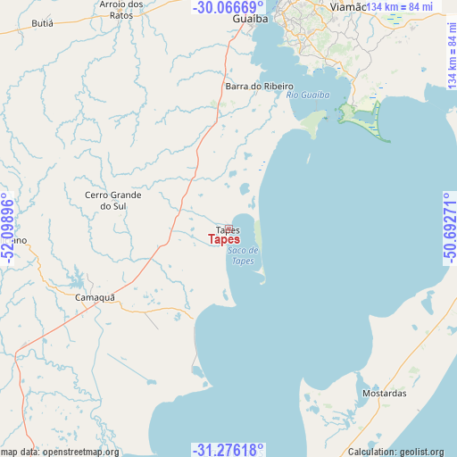
| Upper-left | -30.06669°, | -52.09896° |
| Center: | -30.67333°, | -51.39583° |
| Lower-right: | -31.27618°, | -50.69271° |
| Map W x H: | 134.5×134.5 km | = 83.6×83.6mi |
| max Lat: | 2.81972° ⇑99.3% North |
| Tapes: | -30.67333° |
| min Lat: | ⇓0.7% South -33.69111° |
| min Long | Tapes | max Long |
| -72.89583° | -51.39583° | -32.41083° |
| W 14.9%⇐ | ⇒85.1% E |
Elevation
Elevation of Tapes is 9 m = 30 ft, and this is 371.9 m = 1220 ft below average elevation for this country.
| Max E: |
1603 m = 5259 ft | 95.4% |
| Avg. | 380.9 m = 1250 ft | |
| Tapes | 9 m = 30 ft | |
Min E: |
0 m = 0 ft | 4.6% |
See also: Brazil elevation on elevation.city.
Geographical zone
Tapes is located in South temperate zone (between Tropic of Capricorn and the Antarctic Circle). Distance of this Southern Tropic circle is 804.6 km =500 mi to North.| Distance of | km | miles | from Tapes |
|---|---|---|---|
| Equator | 3410.6 | 2119.2 | to North |
| Tropic Capricorn | 804.6 | 500 | to North |
| Antarctic Circle | 3990.6 | 2479.6 | to South |
| South Pole | 6596.5 | 4098.9 | to South |


Nearby cities:
15 places around Tapes: (largest is in red/bold)
• Arroio dos Ratos
73.6 km =45.7 mi,  334°
334°
• Butiá
82.1 km =51 mi,  318°
318°
• Cachoeirinha
85.4 km =53.1 mi,  19°
19°
• Camaquã
44.4 km =27.6 mi,  243°
243°
• Canoas
86.4 km =53.7 mi,  13°
13°
• Charqueadas
82.9 km =51.5 mi,  344°
344°
• Esteio
92.6 km =57.5 mi, 12°
• Gravataí
90 km =55.9 mi,  25°
25°
• Guaíba
62.6 km =38.9 mi, 6°
• Porto Alegre
73 km =45.4 mi, 12°
• Sapucaia
96.3 km =59.8 mi, 14°
• São Jerônimo
85.4 km =53.1 mi, 338°
• São Lourenço do Sul
94.9 km =59 mi,  215°
215°
• Triunfo
86.9 km =54 mi, 339°
• Viamão
74.9 km =46.5 mi, 28°
Sources, notices
• [Note1] Compared only with cities in Brazil existing in our database
• [Src1] Map data: © OpenStreetMap contributors (CC-BY-SA)
• [Src2] Other city data from geonames.org with taken over terms of usage.
• [Src3] Geographical zone / Annual Mean Temperature by Robert A. Rohde @ Wikipedia
