Charqueadas geodata
Charqueadas (Rio Grande do Sul) is a populated place; located in Brazil in America/Sao_Paulo (GMT-3) time zone. With population of 32,076 people, there are 635 cities with bigger population in this country. Compared to other cities in Brazil, 98.4% of cities are located further ↑North; 86.1% of cities are located further →East and 87.8% of cities have higher elevation than Charqueadas. Note1


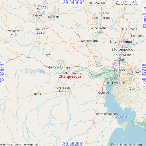
Charqueadas GPS coordinates[2]
29° 57' 16.992" South, 51° 37' 31.008" West
| Map corner | latitude | longitude |
|---|---|---|
| Upper-left | -29.34366°, | -52.32841° |
| Center: | -29.95472°, | -51.62528° |
| Lower-right: | -30.56205°, | -50.92216° |
| Map W x H: | 135.5×135.5 km | = 84.2×84.2mi |
| max Lat: | 2.81972° ⇑98.4% North |
| Charqueadas: | -29.95472° |
| min Lat: | ⇓1.6% South -33.69111° |
| min Long | Charqueadas | max Long |
| -72.89583° | -51.62528° | -32.41083° |
| W 13.9%⇐ | ⇒86.1% E |
Elevation
Elevation of Charqueadas is 22 m = 72 ft, and this is 358.9 m = 1177 ft below average elevation for this country.
| Max E: |
1603 m = 5259 ft | 87.8% |
| Avg. | 380.9 m = 1250 ft | |
| Charqueadas | 22 m = 72 ft | |
Min E: |
0 m = 0 ft | 12.2% |
See also: Brazil elevation on elevation.city.
Geographical zone
Charqueadas is located in South temperate zone (between Tropic of Capricorn and the Antarctic Circle). Distance of this Southern Tropic circle is 724.7 km =450.3 mi to North.| Distance of | km | miles | from Charqueadas |
|---|---|---|---|
| Equator | 3330.7 | 2069.6 | to North |
| Tropic Capricorn | 724.7 | 450.3 | to North |
| Antarctic Circle | 4070.5 | 2529.3 | to South |
| South Pole | 6676.4 | 4148.5 | to South |


Nearby cities:
15 places around Charqueadas: (largest is in red/bold)
• Arroio dos Ratos
16.9 km =10.5 mi,  216°
216°
• Butiá
37.3 km =23.2 mi,  240°
240°
• Cachoeirinha
51.2 km =31.8 mi,  89°
89°
• Canoas
42.8 km =26.6 mi,  84°
84°
• Esteio
44.2 km =27.5 mi, 76°
• Guaíba
33.9 km =21.1 mi,  121°
121°
• Montenegro
33.6 km =20.9 mi,  28°
28°
• Porto Alegre
39 km =24.2 mi,  102°
102°
• Portão
46.5 km =28.9 mi,  52°
52°
• Sapucaia
47.8 km =29.7 mi,  73°
73°
• São Jerônimo
9.4 km =5.8 mi,  266°
266°
• São Leopoldo
50.9 km =31.6 mi,  64°
64°
• São Sebastião do Caí
47.5 km =29.5 mi, 30°
• Taquari
28.8 km =17.9 mi,  306°
306°
• Triunfo
9 km =5.6 mi,  278°
278°
Sources, notices
• [Note1] Compared only with cities in Brazil existing in our database
• [Src1] Map data: © OpenStreetMap contributors (CC-BY-SA)
• [Src2] Other city data from geonames.org with taken over terms of usage.
• [Src3] Geographical zone / Annual Mean Temperature by Robert A. Rohde @ Wikipedia
