São Jerônimo geodata
São Jerônimo (Rio Grande do Sul) is a populated place; located in Brazil in America/Sao_Paulo (GMT-3) time zone. With population of 17,056 people, there are 1093 cities with bigger population in this country. Compared to other cities in Brazil, 98.5% of cities are located further ↑North; 86.5% of cities are located further →East and 89.9% of cities have higher elevation than São Jerônimo. Note1


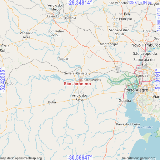
São Jerônimo GPS coordinates[2]
29° 57' 33.012" South, 51° 43' 19.992" West
| Map corner | latitude | longitude |
|---|---|---|
| Upper-left | -29.34814°, | -52.42535° |
| Center: | -29.95917°, | -51.72222° |
| Lower-right: | -30.56647°, | -51.0191° |
| Map W x H: | 135.5×135.5 km | = 84.2×84.2mi |
| max Lat: | 2.81972° ⇑98.5% North |
| São Jerônimo: | -29.95917° |
| min Lat: | ⇓1.5% South -33.69111° |
| min Long | São Jerônimo | max Long |
| -72.89583° | -51.72222° | -32.41083° |
| W 13.5%⇐ | ⇒86.5% E |
Elevation
Elevation of São Jerônimo is 18 m = 59 ft, and this is 362.9 m = 1191 ft below average elevation for this country.
| Max E: |
1603 m = 5259 ft | 89.9% |
| Avg. | 380.9 m = 1250 ft | |
| São Jerônimo | 18 m = 59 ft | |
Min E: |
0 m = 0 ft | 10.1% |
See also: Brazil elevation on elevation.city.
Geographical zone
São Jerônimo is located in South temperate zone (between Tropic of Capricorn and the Antarctic Circle). Distance of this Southern Tropic circle is 725.2 km =450.6 mi to North.| Distance of | km | miles | from São Jerônimo |
|---|---|---|---|
| Equator | 3331.1 | 2069.8 | to North |
| Tropic Capricorn | 725.2 | 450.6 | to North |
| Antarctic Circle | 4070 | 2529 | to South |
| South Pole | 6675.9 | 4148.2 | to South |


Nearby cities:
15 places around São Jerônimo: (largest is in red/bold)
• Arroio dos Ratos
13.1 km =8.1 mi,  182°
182°
• Butiá
29.2 km =18.1 mi,  232°
232°
• Canoas
52.1 km =32.4 mi,  84°
84°
• Charqueadas
9.4 km =5.8 mi,  86°
86°
• Esteio
53.5 km =33.2 mi, 78°
• Guaíba
41.9 km =26 mi,  114°
114°
• Lajeado
59.4 km =36.9 mi,  337°
337°
• Montenegro
39.2 km =24.4 mi,  39°
39°
• Porto Alegre
48.1 km =29.9 mi,  99°
99°
• Portão
54.5 km =33.9 mi,  58°
58°
• Sapucaia
56.9 km =35.4 mi, 75°
• São Sebastião do Caí
53.2 km =33.1 mi, 38°
• Taquari
22.4 km =13.9 mi,  322°
322°
• Teutônia
57.4 km =35.7 mi,  351°
351°
• Triunfo
1.8 km =1.1 mi,  12°
12°
Sources, notices
• [Note1] Compared only with cities in Brazil existing in our database
• [Src1] Map data: © OpenStreetMap contributors (CC-BY-SA)
• [Src2] Other city data from geonames.org with taken over terms of usage.
• [Src3] Geographical zone / Annual Mean Temperature by Robert A. Rohde @ Wikipedia
