São Sebastião do Caí geodata
São Sebastião do Caí (Rio Grande do Sul) is a populated place; located in Brazil in America/Sao_Paulo (GMT-3) time zone. With population of 19,012 people, there are 982 cities with bigger population in this country. Compared to other cities in Brazil, 97% of cities are located further ↑North; 84.8% of cities are located further →East and 90.9% of cities have higher elevation than São Sebastião do Caí. Note1


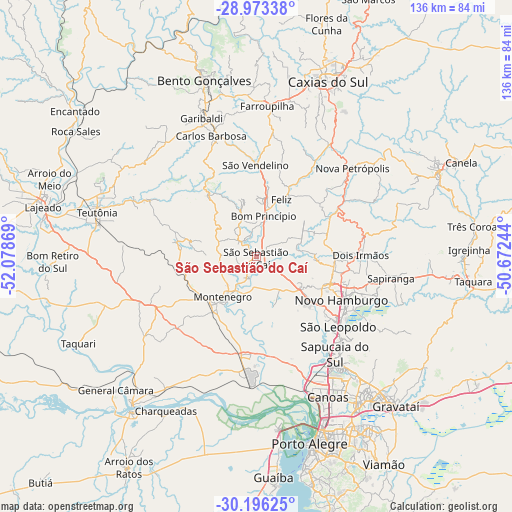
São Sebastião do Caí GPS coordinates[2]
29° 35' 12.012" South, 51° 22' 32.016" West
| Map corner | latitude | longitude |
|---|---|---|
| Upper-left | -28.97338°, | -52.07869° |
| Center: | -29.58667°, | -51.37556° |
| Lower-right: | -30.19625°, | -50.67244° |
| Map W x H: | 136×136 km | = 84.5×84.5mi |
| max Lat: | 2.81972° ⇑97% North |
| São Sebastião do Caí: | -29.58667° |
| min Lat: | ⇓3% South -33.69111° |
| min Long | São Sebastião | max Long |
| -72.89583° | -51.37556° | -32.41083° |
| W 15.2%⇐ | ⇒84.8% E |
Elevation
Elevation of São Sebastião do Caí is 16 m = 52 ft, and this is 364.9 m = 1197 ft below average elevation for this country.
| Max E: |
1603 m = 5259 ft | 90.9% |
| Avg. | 380.9 m = 1250 ft | |
| São Sebastião do Caí | 16 m = 52 ft | |
Min E: |
0 m = 0 ft | 9.1% |
See also: Brazil elevation on elevation.city.
Geographical zone
São Sebastião do Caí is located in South temperate zone (between Tropic of Capricorn and the Antarctic Circle). Distance of this Southern Tropic circle is 683.8 km =424.9 mi to North.| Distance of | km | miles | from São Sebastião do Caí |
|---|---|---|---|
| Equator | 3289.7 | 2044.1 | to North |
| Tropic Capricorn | 683.8 | 424.9 | to North |
| Antarctic Circle | 4111.4 | 2554.7 | to South |
| South Pole | 6717.3 | 4173.9 | to South |


Nearby cities:
15 places around São Sebastião do Caí: (largest is in red/bold)
• Canoas
41.2 km =25.6 mi,  153°
153°
• Carlos Barbosa
34.5 km =21.4 mi,  338°
338°
• Esteio
36 km =22.4 mi, 148°
• Estância Velha
20.7 km =12.9 mi,  109°
109°
• Farroupilha
40.3 km =25 mi,  3°
3°
• Garibaldi
39.8 km =24.7 mi, 337°
• Ivoti
20.8 km =12.9 mi,  91°
91°
• Montenegro
14 km =8.7 mi,  216°
216°
• Nova Petrópolis
34.4 km =21.4 mi,  47°
47°
• Novo Hamburgo
25.8 km =16 mi, 113°
• Portão
18.2 km =11.3 mi,  134°
134°
• Sapiranga
36.1 km =22.4 mi,  99°
99°
• Sapucaia
35 km =21.7 mi,  141°
141°
• São Leopoldo
29.3 km =18.2 mi, 131°
• Teutônia
44.4 km =27.6 mi,  290°
290°
Sources, notices
• [Note1] Compared only with cities in Brazil existing in our database
• [Src1] Map data: © OpenStreetMap contributors (CC-BY-SA)
• [Src2] Other city data from geonames.org with taken over terms of usage.
• [Src3] Geographical zone / Annual Mean Temperature by Robert A. Rohde @ Wikipedia
