Peruíbe geodata
Peruíbe (São Paulo) is a populated place; located in Brazil in America/Sao_Paulo (GMT-3) time zone. With population of 63,030 people, there are 357 cities with bigger population in this country. Compared to other cities in Brazil, 86.8% of cities are located further ↑North; 58.8% of cities are located further →East and 93.7% of cities have higher elevation than Peruíbe. Note1


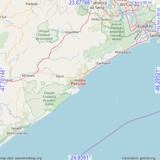
Peruíbe GPS coordinates[2]
24° 19' 12" South, 46° 59' 53.988" West
| Map corner | latitude | longitude |
|---|---|---|
| Upper-left | -23.67766°, | -47.70146° |
| Center: | -24.32°, | -46.99833° |
| Lower-right: | -24.9591°, | -46.29521° |
| Map W x H: | 142.5×142.5 km | = 88.5×88.5mi |
| max Lat: | 2.81972° ⇑86.8% North |
| Peruíbe: | -24.32° |
| min Lat: | ⇓13.2% South -33.69111° |
| min Long | Peruíbe | max Long |
| -72.89583° | -46.99833° | -32.41083° |
| W 41.2%⇐ | ⇒58.8% E |
Elevation
Elevation of Peruíbe is 11 m = 36 ft, and this is 369.9 m = 1214 ft below average elevation for this country.
| Max E: |
1603 m = 5259 ft | 93.7% |
| Avg. | 380.9 m = 1250 ft | |
| Peruíbe | 11 m = 36 ft | |
Min E: |
0 m = 0 ft | 6.3% |
See also: Peruíbe elevation on elevation.city.
Geographical zone
Peruíbe is located in South temperate zone (between Tropic of Capricorn and the Antarctic Circle). Distance of this Southern Tropic circle is 98.2 km =61 mi to North.| Distance of | km | miles | from Peruíbe |
|---|---|---|---|
| Equator | 2704.1 | 1680.2 | to North |
| Tropic Capricorn | 98.2 | 61 | to North |
| Antarctic Circle | 4697 | 2918.6 | to South |
| South Pole | 7302.9 | 4537.8 | to South |


Nearby cities:
15 places around Peruíbe: (largest is in red/bold)
• Cubatão
74.9 km =46.5 mi,  50°
50°
• Embu
76.1 km =47.3 mi,  11°
11°
• Embu Guaçu
57.5 km =35.7 mi,  19°
19°
• Ibiúna
77.2 km =48 mi,  342°
342°
• Iguape
71 km =44.1 mi,  232°
232°
• Itanhaém
26.1 km =16.2 mi, 54°
• Itapecerica da Serra
68.7 km =42.7 mi, 12°
• Juquitiba
43.8 km =27.2 mi,  350°
350°
• Juquiá
64.5 km =40.1 mi,  269°
269°
• Miracatu
47 km =29.2 mi,  275°
275°
• Mongaguá
45.9 km =28.5 mi,  56°
56°
• Praia Grande
69.8 km =43.4 mi, 59°
• Santos
78.4 km =48.7 mi, 59°
• São Lourenço da Serra
52.3 km =32.5 mi, 6°
• São Vicente
73.2 km =45.5 mi, 57°
Sources, notices
• [Note1] Compared only with cities in Brazil existing in our database
• [Src1] Map data: © OpenStreetMap contributors (CC-BY-SA)
• [Src2] Other city data from geonames.org with taken over terms of usage.
• [Src3] Geographical zone / Annual Mean Temperature by Robert A. Rohde @ Wikipedia
