Paranavaí geodata
Paranavaí (Paraná) is a populated place; located in Brazil in America/Sao_Paulo (GMT-3) time zone. With population of 72,848 people, there are 309 cities with bigger population in this country. Compared to other cities in Brazil, 79.3% of cities are located further ↑North; 89.1% of cities are located further →East and 58.3% of cities have lower elevation than Paranavaí. Note1


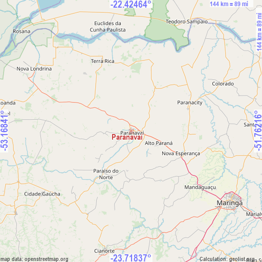
Paranavaí GPS coordinates[2]
23° 4' 23.016" South, 52° 27' 55.008" West
| Map corner | latitude | longitude |
|---|---|---|
| Upper-left | -22.42464°, | -53.16841° |
| Center: | -23.07306°, | -52.46528° |
| Lower-right: | -23.71837°, | -51.76216° |
| Map W x H: | 143.8×143.9 km | = 89.4×89.4mi |
| max Lat: | 2.81972° ⇑79.3% North |
| Paranavaí: | -23.07306° |
| min Lat: | ⇓20.7% South -33.69111° |
| min Long | Paranavaí | max Long |
| -72.89583° | -52.46528° | -32.41083° |
| W 10.9%⇐ | ⇒89.1% E |
Elevation
Elevation of Paranavaí is 456 m = 1496 ft, and this is 75.1 m = 246 ft above average elevation for this country.
| Max E: |
1603 m = 5259 ft | 41.7% |
| Paranavaí | 456 m 1496 ft | |
| Avg. | 380.9 m = 1250 ft | |
Min E: |
0 m = 0 ft | 58.3% |
See also: Paranavaí elevation on elevation.city.
Geographical zone
Paranavaí is located in South Torrid zone (between Equator and Tropic of Capricorn). Distance of this Southern Tropic circle is 40.4 km =25.1 mi to South.| Distance of | km | miles | from Paranavaí |
|---|---|---|---|
| Equator | 2565.5 | 1594.1 | to North |
| Tropic Capricorn | 40.4 | 25.1 | to South |
| Antarctic Circle | 4835.7 | 3004.8 | to South |
| South Pole | 7441.6 | 4624 | to South |


Nearby cities:
15 places around Paranavaí: (largest is in red/bold)
• Alto Paraná
16.2 km =10.1 mi,  112°
112°
• Cianorte
67.2 km =41.8 mi,  192°
192°
• Colorado
56.8 km =35.3 mi,  62°
62°
• Engenheiro Beltrão
83 km =51.6 mi,  166°
166°
• Loanda
70.8 km =44 mi,  283°
283°
• Mandaguaçu
48.6 km =30.2 mi,  128°
128°
• Marialva
82.7 km =51.4 mi,  123°
123°
• Maringá
66.5 km =41.3 mi, 126°
• Nova Aurora
25.2 km =15.7 mi,  335°
335°
• Nova Londrina
63.2 km =39.3 mi,  302°
302°
• Paiçandu
60.3 km =37.5 mi,  135°
135°
• Sarandi
73.1 km =45.4 mi, 124°
• Teodoro Sampaio
67.4 km =41.9 mi,  26°
26°
• Terra Boa
77.3 km =48 mi,  178°
178°
• Terra Rica
43.3 km =26.9 mi, 338°
Sources, notices
• [Note1] Compared only with cities in Brazil existing in our database
• [Src1] Map data: © OpenStreetMap contributors (CC-BY-SA)
• [Src2] Other city data from geonames.org with taken over terms of usage.
• [Src3] Geographical zone / Annual Mean Temperature by Robert A. Rohde @ Wikipedia
