Loanda geodata
Loanda (Paraná) is a populated place; located in Brazil in America/Sao_Paulo (GMT-3) time zone. With population of 18,233 people, there are 1027 cities with bigger population in this country. Compared to other cities in Brazil, 77.9% of cities are located further ↑North; 90.8% of cities are located further →East and 59% of cities have lower elevation than Loanda. Note1


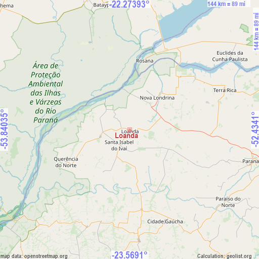
Loanda GPS coordinates[2]
22° 55' 23.016" South, 53° 8' 13.992" West
| Map corner | latitude | longitude |
|---|---|---|
| Upper-left | -22.27393°, | -53.84035° |
| Center: | -22.92306°, | -53.13722° |
| Lower-right: | -23.5691°, | -52.4341° |
| Map W x H: | 144×144 km | = 89.5×89.5mi |
| max Lat: | 2.81972° ⇑77.9% North |
| Loanda: | -22.92306° |
| min Lat: | ⇓22.1% South -33.69111° |
| min Long | Loanda | max Long |
| -72.89583° | -53.13722° | -32.41083° |
| W 9.2%⇐ | ⇒90.8% E |
Elevation
Elevation of Loanda is 464 m = 1522 ft, and this is 83.1 m = 273 ft above average elevation for this country.
| Max E: |
1603 m = 5259 ft | 41% |
| Loanda | 464 m 1522 ft | |
| Avg. | 380.9 m = 1250 ft | |
Min E: |
0 m = 0 ft | 59% |
See also: Brazil elevation on elevation.city.
Geographical zone
Loanda is located in South Torrid zone (between Equator and Tropic of Capricorn). Distance of this Southern Tropic circle is 57.1 km =35.5 mi to South.| Distance of | km | miles | from Loanda |
|---|---|---|---|
| Equator | 2548.8 | 1583.8 | to North |
| Tropic Capricorn | 57.1 | 35.5 | to South |
| Antarctic Circle | 4852.4 | 3015.1 | to South |
| South Pole | 7458.3 | 4634.4 | to South |


Nearby cities:
15 places around Loanda: (largest is in red/bold)
• Alto Paraná
86.8 km =53.9 mi,  105°
105°
• Bataiporã
71.1 km =44.2 mi,  348°
348°
• Cianorte
98.6 km =61.3 mi,  146°
146°
• Cruzeiro do Oeste
96.1 km =59.7 mi,  176°
176°
• Mandaguaçu
116.5 km =72.4 mi, 113°
• Naviraí
109 km =67.7 mi,  261°
261°
• Nova Aurora
58.8 km =36.5 mi,  83°
83°
• Nova Londrina
23.4 km =14.5 mi,  41°
41°
• Paranavaí
70.8 km =44 mi,  103°
103°
• Pôrto Barra do Ivinheima
54.4 km =33.8 mi, 264°
• Tapejara
94 km =58.4 mi,  163°
163°
• Teodoro Sampaio
108.5 km =67.4 mi,  66°
66°
• Terra Boa
117.6 km =73.1 mi,  143°
143°
• Terra Rica
58.4 km =36.3 mi, 65°
• Umuarama
95.7 km =59.5 mi,  191°
191°
Sources, notices
• [Note1] Compared only with cities in Brazil existing in our database
• [Src1] Map data: © OpenStreetMap contributors (CC-BY-SA)
• [Src2] Other city data from geonames.org with taken over terms of usage.
• [Src3] Geographical zone / Annual Mean Temperature by Robert A. Rohde @ Wikipedia
