Pôrto Barra do Ivinheima geodata
Pôrto Barra do Ivinheima (Mato Grosso do Sul) is a populated place; located in Brazil in America/Campo_Grande (GMT-4) time zone. With population of 14,527 people, there are 1248 cities with bigger population in this country. Compared to other cities in Brazil, 78.3% of cities are located further ↑North; 91.8% of cities are located further →East and 58% of cities have higher elevation than Pôrto Barra do Ivinheima. Note1
Current local time in Pôrto Barra do Ivinheima:
10:07 AM, FridayDifference from your time zone: hours


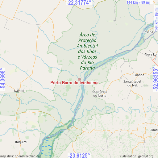
Pôrto Barra do Ivinheima GPS coordinates[2]
22° 58' 0.012" South, 53° 40' 0.012" West
| Map corner | latitude | longitude |
|---|---|---|
| Upper-left | -22.31774°, | -54.3698° |
| Center: | -22.96667°, | -53.66667° |
| Lower-right: | -23.6125°, | -52.96355° |
| Map W x H: | 144×144 km | = 89.5×89.5mi |
| max Lat: | 2.81972° ⇑78.3% North |
| Pôrto Barra do Ivinheima: | -22.96667° |
| min Lat: | ⇓21.7% South -33.69111° |
| min Long | Pôrto Barra do | max Long |
| -72.89583° | -53.66667° | -32.41083° |
| W 8.2%⇐ | ⇒91.8% E |
Elevation
Elevation of Pôrto Barra do Ivinheima is 234 m = 768 ft, and this is 146.9 m = 482 ft below average elevation for this country.
| Max E: |
1603 m = 5259 ft | 58% |
| Avg. | 380.9 m = 1250 ft | |
| Pôrto Barra do Ivinheima | 234 m = 768 ft | |
Min E: |
0 m = 0 ft | 42% |
See also: Brazil elevation on elevation.city.
Geographical zone
Pôrto Barra do Ivinheima is located in South Torrid zone (between Equator and Tropic of Capricorn). Distance of this Southern Tropic circle is 52.3 km =32.5 mi to South.| Distance of | km | miles | from Pôrto Barra do Ivinheima |
|---|---|---|---|
| Equator | 2553.7 | 1586.8 | to North |
| Tropic Capricorn | 52.3 | 32.5 | to South |
| Antarctic Circle | 4847.5 | 3012.1 | to South |
| South Pole | 7453.4 | 4631.3 | to South |


Nearby cities:
15 places around Pôrto Barra do Ivinheima: (largest is in red/bold)
• Alto Piquiri
120.2 km =74.7 mi,  168°
168°
• Altãnia
103.7 km =64.4 mi,  193°
193°
• Bataiporã
85 km =52.8 mi,  28°
28°
• Costa Rica
112.3 km =69.8 mi,  243°
243°
• Cruzeiro do Oeste
109.3 km =67.9 mi,  146°
146°
• Eldorado
110.8 km =68.8 mi,  214°
214°
• Iguatemi
121 km =75.2 mi,  229°
229°
• Iporã
115.3 km =71.6 mi,  181°
181°
• Loanda
54.4 km =33.8 mi,  84°
84°
• Naviraí
54.7 km =34 mi,  258°
258°
• Nova Aurora
113.2 km =70.3 mi, 84°
• Nova Londrina
73.3 km =45.5 mi,  72°
72°
• Tapejara
117.6 km =73.1 mi,  136°
136°
• Terra Rica
111.3 km =69.2 mi, 75°
• Umuarama
95.5 km =59.3 mi,  158°
158°
Sources, notices
• [Note1] Compared only with cities in Brazil existing in our database
• [Src1] Map data: © OpenStreetMap contributors (CC-BY-SA)
• [Src2] Other city data from geonames.org with taken over terms of usage.
• [Src3] Geographical zone / Annual Mean Temperature by Robert A. Rohde @ Wikipedia
