Itapevi geodata
Itapevi (São Paulo) is a seat of a second-order administrative division; located in Brazil in America/Sao_Paulo (GMT-3) time zone. With population of 201,748 people, there are 114 cities with bigger population in this country. Compared to other cities in Brazil, 83.4% of cities are located further ↑North; 58.1% of cities are located further →East and 86.8% of cities have lower elevation than Itapevi. Note1


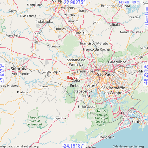
Itapevi GPS coordinates[2]
23° 32' 56.004" South, 46° 56' 3.012" West
| Map corner | latitude | longitude |
|---|---|---|
| Upper-left | -22.90275°, | -47.6373° |
| Center: | -23.54889°, | -46.93417° |
| Lower-right: | -24.19187°, | -46.23105° |
| Map W x H: | 143.3×143.3 km | = 89×89mi |
| max Lat: | 2.81972° ⇑83.4% North |
| Itapevi: | -23.54889° |
| min Lat: | ⇓16.6% South -33.69111° |
| min Long | Itapevi | max Long |
| -72.89583° | -46.93417° | -32.41083° |
| W 41.9%⇐ | ⇒58.1% E |
Elevation
Elevation of Itapevi is 772 m = 2533 ft, and this is 391.1 m = 1283 ft above average elevation for this country.
| Max E: |
1603 m = 5259 ft | 13.2% |
| Itapevi | 772 m 2533 ft | |
| Avg. | 380.9 m = 1250 ft | |
Min E: |
0 m = 0 ft | 86.8% |
See also: Itapevi elevation on elevation.city.
Geographical zone
Itapevi is located in South temperate zone (between Tropic of Capricorn and the Antarctic Circle). Distance of this Southern Tropic circle is 12.5 km =7.8 mi to North.| Distance of | km | miles | from Itapevi |
|---|---|---|---|
| Equator | 2618.4 | 1627 | to North |
| Tropic Capricorn | 12.5 | 7.8 | to North |
| Antarctic Circle | 4782.8 | 2971.9 | to South |
| South Pole | 7388.7 | 4591.1 | to South |


Nearby cities:
15 places around Itapevi: (largest is in red/bold)
• Barueri
7.3 km =4.5 mi,  54°
54°
• Cajamar
22.2 km =13.8 mi,  15°
15°
• Carapicuíba
10.5 km =6.5 mi,  73°
73°
• Cotia
6.3 km =3.9 mi,  165°
165°
• Embu
13.9 km =8.6 mi,  143°
143°
• Itapecerica da Serra
20.6 km =12.8 mi,  155°
155°
• Jandira
4 km =2.5 mi, 53°
• Jardim Paulista
27.6 km =17.1 mi,  94°
94°
• Mairinque
25.4 km =15.8 mi,  270°
270°
• Osasco
14.6 km =9.1 mi,  82°
82°
• Pirapora do Bom Jesus
18.3 km =11.4 mi,  337°
337°
• Santana de Parnaíba
11.8 km =7.3 mi,  8°
8°
• São Roque
20.6 km =12.8 mi,  276°
276°
• Taboão da Serra
16.9 km =10.5 mi,  120°
120°
• Vargem Grande Paulista
11.2 km =7 mi,  237°
237°
Sources, notices
• [Note1] Compared only with cities in Brazil existing in our database
• [Src1] Map data: © OpenStreetMap contributors (CC-BY-SA)
• [Src2] Other city data from geonames.org with taken over terms of usage.
• [Src3] Geographical zone / Annual Mean Temperature by Robert A. Rohde @ Wikipedia
