São Roque geodata
São Roque (São Paulo) is a seat of a second-order administrative division; located in Brazil in America/Sao_Paulo (GMT-3) time zone. With population of 50,540 people, there are 425 cities with bigger population in this country. Compared to other cities in Brazil, 82.9% of cities are located further ↑North; 59.4% of cities are located further →East and 86.9% of cities have lower elevation than São Roque. Note1


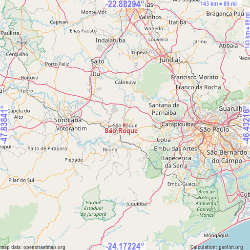
São Roque GPS coordinates[2]
23° 31' 45.012" South, 47° 8' 7.008" West
| Map corner | latitude | longitude |
|---|---|---|
| Upper-left | -22.88294°, | -47.83841° |
| Center: | -23.52917°, | -47.13528° |
| Lower-right: | -24.17224°, | -46.43216° |
| Map W x H: | 143.4×143.4 km | = 89.1×89.1mi |
| max Lat: | 2.81972° ⇑82.9% North |
| São Roque: | -23.52917° |
| min Lat: | ⇓17.1% South -33.69111° |
| min Long | São Roque | max Long |
| -72.89583° | -47.13528° | -32.41083° |
| W 40.6%⇐ | ⇒59.4% E |
Elevation
Elevation of São Roque is 773 m = 2536 ft, and this is 392.1 m = 1286 ft above average elevation for this country.
| Max E: |
1603 m = 5259 ft | 13.1% |
| São Roque | 773 m 2536 ft | |
| Avg. | 380.9 m = 1250 ft | |
Min E: |
0 m = 0 ft | 86.9% |
See also: São Roque elevation on elevation.city.
Geographical zone
São Roque is located in South temperate zone (between Tropic of Capricorn and the Antarctic Circle). Distance of this Southern Tropic circle is 10.3 km =6.4 mi to North.| Distance of | km | miles | from São Roque |
|---|---|---|---|
| Equator | 2616.2 | 1625.6 | to North |
| Tropic Capricorn | 10.3 | 6.4 | to North |
| Antarctic Circle | 4785 | 2973.3 | to South |
| South Pole | 7390.9 | 4592.5 | to South |


Nearby cities:
15 places around São Roque: (largest is in red/bold)
• Barueri
26.5 km =16.5 mi,  85°
85°
• Cabreúva
24.6 km =15.3 mi,  0°
0°
• Cajamar
32.6 km =20.3 mi,  53°
53°
• Carapicuíba
30.6 km =19 mi, 88°
• Cotia
23.5 km =14.6 mi,  110°
110°
• Embu
31.8 km =19.8 mi, 114°
• Ibiúna
16.7 km =10.4 mi,  212°
212°
• Itapevi
20.6 km =12.8 mi,  96°
96°
• Jandira
23.7 km =14.7 mi, 89°
• Mairinque
5.2 km =3.2 mi,  249°
249°
• Pirapora do Bom Jesus
20 km =12.4 mi,  42°
42°
• Santana de Parnaíba
24.1 km =15 mi,  66°
66°
• Sorocaba
33.1 km =20.6 mi,  275°
275°
• Vargem Grande Paulista
13.8 km =8.6 mi,  126°
126°
• Votorantim
30.9 km =19.2 mi,  266°
266°
Sources, notices
• [Note1] Compared only with cities in Brazil existing in our database
• [Src1] Map data: © OpenStreetMap contributors (CC-BY-SA)
• [Src2] Other city data from geonames.org with taken over terms of usage.
• [Src3] Geographical zone / Annual Mean Temperature by Robert A. Rohde @ Wikipedia
