Ruy Barbosa geodata
Ruy Barbosa (Bahia) is a populated place; located in Brazil in America/Bahia (GMT-3) time zone. With population of 21,093 people, there are 901 cities with bigger population in this country. Compared to other cities in Brazil, 61.8% of cities are located further ↓South; 72.7% of cities are located further ←West and 50.6% of cities have higher elevation than Ruy Barbosa. Note1


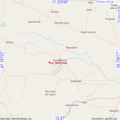
Ruy Barbosa GPS coordinates[2]
12° 17' 2.004" South, 40° 29' 38.004" West
| Map corner | latitude | longitude |
|---|---|---|
| Upper-left | -11.59598°, | -41.19702° |
| Center: | -12.28389°, | -40.49389° |
| Lower-right: | -12.97°, | -39.79077° |
| Map W x H: | 152.8×152.8 km | = 94.9×94.9mi |
| max Lat: | 2.81972° ⇑38.2% North |
| Ruy Barbosa: | -12.28389° |
| min Lat: | ⇓61.8% South -33.69111° |
| min Long | Ruy Barbosa | max Long |
| -72.89583° | -40.49389° | -32.41083° |
| W 72.7%⇐ | ⇒27.3% E |
Elevation
Elevation of Ruy Barbosa is 344 m = 1129 ft, and this is 36.9 m = 121 ft below average elevation for this country.
| Max E: |
1603 m = 5259 ft | 50.6% |
| Avg. | 380.9 m = 1250 ft | |
| Ruy Barbosa | 344 m = 1129 ft | |
Min E: |
0 m = 0 ft | 49.4% |
See also: Brazil elevation on elevation.city.
Geographical zone
Ruy Barbosa is located in South Torrid zone (between Equator and Tropic of Capricorn). Distance of this Southern Tropic circle is 1240.1 km =770.6 mi to South.| Distance of | km | miles | from Ruy Barbosa |
|---|---|---|---|
| Equator | 1365.8 | 848.7 | to North |
| Tropic Capricorn | 1240.1 | 770.6 | to South |
| Antarctic Circle | 6035.3 | 3750.2 | to South |
| South Pole | 8641.2 | 5369.4 | to South |


Nearby cities:
15 places around Ruy Barbosa: (largest is in red/bold)
• Baixa Grande
50.5 km =31.4 mi,  44°
44°
• Capim Grosso
113.2 km =70.3 mi,  27°
27°
• Iaçu
61.9 km =38.5 mi,  150°
150°
• Ipirá
83.4 km =51.8 mi,  80°
80°
• Iraquara
122.4 km =76.1 mi,  271°
271°
• Itaberaba
33.9 km =21.1 mi,  143°
143°
• Jacobina
122.6 km =76.2 mi,  358°
358°
• Mairi
73.9 km =45.9 mi, 30°
• Miguel Calmon
95.7 km =59.5 mi,  353°
353°
• Morro do Chapéu
109.1 km =67.8 mi,  318°
318°
• Mundo Novo
47.3 km =29.4 mi,  2°
2°
• Piritiba
61.9 km =38.5 mi, 353°
• Tapiramutá
58.3 km =36.2 mi,  326°
326°
• Terra Nova
20.9 km =13 mi,  243°
243°
• Vera Cruz
70.3 km =43.7 mi, 236°
Sources, notices
• [Note1] Compared only with cities in Brazil existing in our database
• [Src1] Map data: © OpenStreetMap contributors (CC-BY-SA)
• [Src2] Other city data from geonames.org with taken over terms of usage.
• [Src3] Geographical zone / Annual Mean Temperature by Robert A. Rohde @ Wikipedia
