Extrema geodata
Extrema (Rondônia) is a populated place; located in Brazil in America/Porto_Velho (GMT-4) time zone. With population of 6,176 people, there are 1872 cities with bigger population in this country. Compared to other cities in Brazil, 68.5% of cities are located further ↓South; 98.8% of cities are located further →East and 67.8% of cities have higher elevation than Extrema. Note1


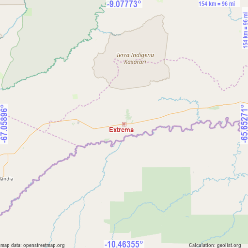
Extrema GPS coordinates[2]
9° 46' 16.896" South, 66° 21' 20.988" West
| Map corner | latitude | longitude |
|---|---|---|
| Upper-left | -9.07773°, | -67.05896° |
| Center: | -9.77136°, | -66.35583° |
| Lower-right: | -10.46355°, | -65.65271° |
| Map W x H: | 154.1×154.1 km | = 95.8×95.8mi |
| max Lat: | 2.81972° ⇑31.5% North |
| Extrema: | -9.77136° |
| min Lat: | ⇓68.5% South -33.69111° |
| min Long | Extrema | max Long |
| -72.89583° | -66.35583° | -32.41083° |
| W 1.2%⇐ | ⇒98.8% E |
Elevation
Elevation of Extrema is 144 m = 472 ft, and this is 236.9 m = 777 ft below average elevation for this country.
| Max E: |
1603 m = 5259 ft | 67.8% |
| Avg. | 380.9 m = 1250 ft | |
| Extrema | 144 m = 472 ft | |
Min E: |
0 m = 0 ft | 32.2% |
See also: Brazil elevation on elevation.city.
Geographical zone
Extrema is located in South Torrid zone (between Equator and Tropic of Capricorn). Distance of Equator is 1086.5 km =675.1 mi to North.| Distance of | km | miles | from Extrema |
|---|---|---|---|
| Equator | 1086.5 | 675.1 | to North |
| Tropic Capricorn | 1519.4 | 944.1 | to South |
| Antarctic Circle | 6314.7 | 3923.8 | to South |
| South Pole | 8920.6 | 5543 | to South |


Nearby cities:
14 places around Extrema: (largest is in red/bold)
• Ariquemes
363.5 km =225.9 mi,  92°
92°
• Boca do Acre
161 km =100 mi,  314°
314°
• Brasiléia
296 km =183.9 mi,  242°
242°
• Canutama
420.4 km =261.2 mi,  31°
31°
• Guajará Mirim
158.5 km =98.5 mi,  135°
135°
• Jaru
432.2 km =268.6 mi,  99°
99°
• Manoel Urbano
335.1 km =208.2 mi,  288°
288°
• Pauini
238.7 km =148.3 mi,  343°
343°
• Plácido de Castro
110.4 km =68.6 mi, 235°
• Porto Velho
291.5 km =181.1 mi,  67°
67°
• Rio Branco
160.9 km =100 mi,  261°
261°
• Sena Madureira
266 km =165.3 mi, 287°
• Senador Guiomard
157 km =97.6 mi,  254°
254°
• Xapuri
254.7 km =158.3 mi, 247°
Sources, notices
• [Note1] Compared only with cities in Brazil existing in our database
• [Src1] Map data: © OpenStreetMap contributors (CC-BY-SA)
• [Src2] Other city data from geonames.org with taken over terms of usage.
• [Src3] Geographical zone / Annual Mean Temperature by Robert A. Rohde @ Wikipedia
