Kalinkavichy geodata
Kalinkavichy (Gomel Oblast) is a seat of a second-order administrative division; located in Belarus in Europe/Minsk (GMT+3) time zone. With population of 37,190 people, there are 25 cities with bigger population in this country. Compared to other cities in Belarus, 94.1% of cities are located further ↑North; 72.7% of cities are located further ←West and 97.4% of cities have higher elevation than Kalinkavichy. Note1


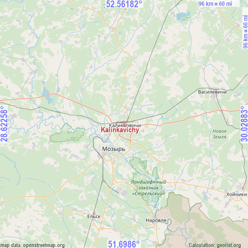
Kalinkavichy GPS coordinates[2]
52° 7' 56.28" North, 29° 19' 32.52" East
| Map corner | latitude | longitude |
|---|---|---|
| Upper-left | 52.56182°, | 28.62258° |
| Center: | 52.1323°, | 29.3257° |
| Lower-right: | 51.6986°, | 30.02883° |
| Map W x H: | 96×96 km | = 59.7×59.7mi |
| max Lat: | 56.0147° ⇑94.1% North |
| Kalinkavichy: | 52.1323° |
| min Lat: | ⇓5.9% South 51.75° |
| min Long | Kalinkavichy | max Long |
| 23.37083° | 29.3257° | 32.578° |
| W 72.7%⇐ | ⇒27.3% E |
Elevation
Elevation of Kalinkavichy is 122 m = 400 ft, and this is 46.6 m = 153 ft below average elevation for this country.
| Max E: |
309 m = 1014 ft | 97.4% |
| Avg. | 168.6 m = 553 ft | |
| Kalinkavichy | 122 m = 400 ft | |
Min E: |
108 m = 354 ft | 2.6% |
See also: Belarus elevation on elevation.city.
Geographical zone
Kalinkavichy is located in North temperate zone (between Tropic of Cancer and the Arctic Circle). Distance of this North polar circle is 1604.6 km =997.1 mi to North.| Distance of | km | miles | from Kalinkavichy |
|---|---|---|---|
| North Pole | 4210.5 | 2616.3 | to North |
| Arctic Circle | 1604.6 | 997.1 | to North |
| Tropic Cancer | 3190.6 | 1982.5 | to South |
| Equator | 5796.6 | 3601.8 | to South |


Nearby cities:
15 places around Kalinkavichy: (largest is in red/bold)
• Aktsyabrski
64.4 km =40 mi,  332°
332°
• Brahin
75.1 km =46.7 mi,  120°
120°
• Hlusk
96 km =59.7 mi, 333°
• Horad Rechytsa
77.2 km =48 mi,  70°
70°
• Khoyniki
50.7 km =31.5 mi, 121°
• Lyel’chytsy
78.4 km =48.7 mi,  240°
240°
• Mazyr
10.7 km =6.6 mi,  210°
210°
• Narowlya
39.3 km =24.4 mi,  162°
162°
• Parychy
75 km =46.6 mi,  4°
4°
• Pyetrykaw
56.9 km =35.4 mi,  269°
269°
• Rechytsa
76.9 km =47.8 mi, 70°
• Sasnovy Bor
46.9 km =29.1 mi,  23°
23°
• Svyetlahorsk
62.3 km =38.7 mi,  26°
26°
• Vasilyevichy
36.8 km =22.9 mi, 68°
• Yel’sk
37.3 km =23.2 mi,  198°
198°
Sources, notices
• [Note1] Compared only with cities in Belarus existing in our database
• [Src1] Map data: © OpenStreetMap contributors (CC-BY-SA)
• [Src2] Other city data from geonames.org with taken over terms of usage.
• [Src3] Geographical zone / Annual Mean Temperature by Robert A. Rohde @ Wikipedia
