Svyetlahorsk geodata
Svyetlahorsk (Gomel Oblast) is a seat of a second-order administrative division; located in Belarus in Europe/Minsk (GMT+3) time zone. With population of 71,250 people, there are 18 cities with bigger population in this country. Compared to other cities in Belarus, 82.6% of cities are located further ↑North; 76.3% of cities are located further ←West and 78.6% of cities have higher elevation than Svyetlahorsk. Note1


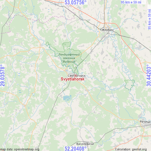
Svyetlahorsk GPS coordinates[2]
52° 37' 58.44" North, 29° 44' 20.04" East
| Map corner | latitude | longitude |
|---|---|---|
| Upper-left | 53.05756°, | 29.03578° |
| Center: | 52.6329°, | 29.7389° |
| Lower-right: | 52.20408°, | 30.44203° |
| Map W x H: | 94.9×94.9 km | = 59×59mi |
| max Lat: | 56.0147° ⇑82.6% North |
| Svyetlahorsk: | 52.6329° |
| min Lat: | ⇓17.4% South 51.75° |
| min Long | Svyetlahorsk | max Long |
| 23.37083° | 29.7389° | 32.578° |
| W 76.3%⇐ | ⇒23.7% E |
Elevation
Elevation of Svyetlahorsk is 142 m = 466 ft, and this is 26.6 m = 87 ft below average elevation for this country.
| Max E: |
309 m = 1014 ft | 78.6% |
| Avg. | 168.6 m = 553 ft | |
| Svyetlahorsk | 142 m = 466 ft | |
Min E: |
108 m = 354 ft | 21.4% |
See also: Svyetlahorsk elevation on elevation.city.
Geographical zone
Svyetlahorsk is located in North temperate zone (between Tropic of Cancer and the Arctic Circle). Distance of this North polar circle is 1548.9 km =962.4 mi to North.| Distance of | km | miles | from Svyetlahorsk |
|---|---|---|---|
| North Pole | 4154.8 | 2581.7 | to North |
| Arctic Circle | 1548.9 | 962.4 | to North |
| Tropic Cancer | 3246.3 | 2017.2 | to South |
| Equator | 5852.2 | 3636.4 | to South |


Nearby cities:
15 places around Svyetlahorsk: (largest is in red/bold)
• Aktsyabrski
58 km =36 mi,  271°
271°
• Babruysk
66.1 km =41.1 mi,  328°
328°
• Buda-Kashalyova
56.8 km =35.3 mi,  80°
80°
• Dowsk
75.7 km =47 mi,  39°
39°
• Horad Rechytsa
53.5 km =33.2 mi,  123°
123°
• Kalinkavichy
62.3 km =38.7 mi,  206°
206°
• Kirawsk
72.9 km =45.3 mi,  345°
345°
• Mazyr
73 km =45.4 mi, 207°
• Myshkavichy
66.7 km =41.4 mi, 346°
• Parychy
28.8 km =17.9 mi,  311°
311°
• Rahachow
55.3 km =34.4 mi,  22°
22°
• Rechytsa
53.5 km =33.2 mi, 124°
• Sasnovy Bor
15.8 km =9.8 mi,  216°
216°
• Vasilyevichy
42.9 km =26.7 mi,  171°
171°
• Zhlobin
34.7 km =21.6 mi,  33°
33°
Sources, notices
• [Note1] Compared only with cities in Belarus existing in our database
• [Src1] Map data: © OpenStreetMap contributors (CC-BY-SA)
• [Src2] Other city data from geonames.org with taken over terms of usage.
• [Src3] Geographical zone / Annual Mean Temperature by Robert A. Rohde @ Wikipedia
