Benque Viejo el Carmen geodata
Benque Viejo el Carmen (Cayo) is a populated place; located in Belize in America/Belize (GMT-6) time zone. With population of 7,092 people, there are 7 cities with bigger population in this country. Compared to other cities in Belize, 72.7% of cities are located further ↑North; 100% of cities are located further →East and 100% of cities have lower elevation than Benque Viejo el Carmen. Note1


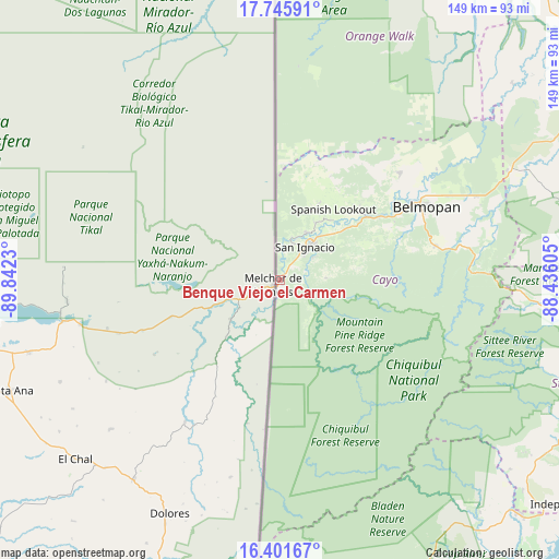
Benque Viejo el Carmen GPS coordinates[2]
17° 4' 30" North, 89° 8' 21.012" West
| Map corner | latitude | longitude |
|---|---|---|
| Upper-left | 17.74591°, | -89.8423° |
| Center: | 17.075°, | -89.13917° |
| Lower-right: | 16.40167°, | -88.43605° |
| Map W x H: | 149.5×149.5 km | = 92.9×92.9mi |
| max Lat: | 18.39375° ⇑72.7% North |
| Benque Viejo el Carmen: | 17.075° |
| min Lat: | ⇓27.3% South 16.09835° |
| min Long | Benque Viejo el | max Long |
| -89.13917° | -89.13917° | -87.9659° |
| W 0%⇐ | ⇒100% E |
Elevation
Elevation of Benque Viejo el Carmen is 89 m = 292 ft, and this is 57.6 m = 189 ft above average elevation for this country.
| Max E: |
89 m = 292 ft | 0% |
| Benque Viejo el Carmen | 89 m 292 ft | |
| Avg. | 31.4 m = 103 ft | |
Min E: |
4 m = 13 ft | 100% |
See also: Belize elevation on elevation.city.
Geographical zone
Benque Viejo el Carmen is located in North Torrid zone (between Equator and Tropic of Cancer). Distance of this Northern Tropic circle is 707.4 km =439.6 mi to North.| Distance of | km | miles | from Benque Viejo el Carmen |
|---|---|---|---|
| North Pole | 8108.5 | 5038.4 | to North |
| Arctic Circle | 5502.6 | 3419.2 | to North |
| Tropic Cancer | 707.4 | 439.6 | to North |
| Equator | 1898.6 | 1179.7 | to South |


Nearby cities:
11 places around Benque Viejo el Carmen: (largest is in red/bold)
• Belize City
110.6 km =68.7 mi,  64°
64°
• Belmopan
44.1 km =27.4 mi, 63°
• Corozal
166.8 km =103.6 mi,  28°
28°
• Dangriga
97 km =60.3 mi,  96°
96°
• Orange Walk
127.5 km =79.2 mi, 28°
• Placencia
103.2 km =64.1 mi,  127°
127°
• Punta Gorda
114.1 km =70.9 mi,  162°
162°
• San Ignacio
11.9 km =7.4 mi,  38°
38°
• San Pedro
155.6 km =96.7 mi,  53°
53°
• Shipyard
104.6 km =65 mi, 29°
• Valley of Peace
43.4 km =27 mi, 48°
Sources, notices
• [Note1] Compared only with cities in Belize existing in our database
• [Src1] Map data: © OpenStreetMap contributors (CC-BY-SA)
• [Src2] Other city data from geonames.org with taken over terms of usage.
• [Src3] Geographical zone / Annual Mean Temperature by Robert A. Rohde @ Wikipedia
