Côte-Saint-Luc geodata
Côte-Saint-Luc (Quebec) is a populated place; located in Canada in America/Toronto (GMT-4) time zone. With population of 31,395 people, there are 142 cities with bigger population in this country. Compared to other cities in Canada, 75.8% of cities are located further ↑North; 65.9% of cities are located further ←West and 73.7% of cities have higher elevation than Côte-Saint-Luc. Note1


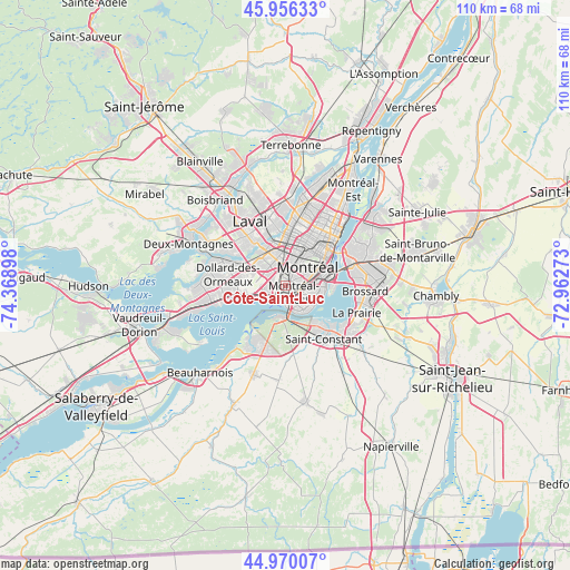
Côte-Saint-Luc GPS coordinates[2]
45° 27' 55.296" North, 73° 39' 57.06" West
| Map corner | latitude | longitude |
|---|---|---|
| Upper-left | 45.95633°, | -74.36898° |
| Center: | 45.46536°, | -73.66585° |
| Lower-right: | 44.97007°, | -72.96273° |
| Map W x H: | 109.7×109.7 km | = 68.2×68.2mi |
| max Lat: | 73.03752° ⇑75.8% North |
| Côte-Saint-Luc: | 45.46536° |
| min Lat: | ⇓24.2% South 42.05009° |
| min Long | Côte-Saint-Luc | max Long |
| -139.43328° | -73.66585° | -52.70931° |
| W 65.9%⇐ | ⇒34.1% E |
Elevation
Elevation of Côte-Saint-Luc is 47 m = 154 ft, and this is 207.4 m = 680 ft below average elevation for this country.
| Max E: |
1518 m = 4980 ft | 73.7% |
| Avg. | 254.4 m = 835 ft | |
| Côte-Saint-Luc | 47 m = 154 ft | |
Min E: |
-2 m = -7 ft | 26.3% |
See also: Canada elevation on elevation.city.
Geographical zone
Côte-Saint-Luc is located in North temperate zone (between Tropic of Cancer and the Arctic Circle). Distance of this North polar circle is 2345.9 km =1457.7 mi to North.| Distance of | km | miles | from Côte-Saint-Luc |
|---|---|---|---|
| North Pole | 4951.8 | 3076.9 | to North |
| Arctic Circle | 2345.9 | 1457.7 | to North |
| Tropic Cancer | 2449.4 | 1522 | to South |
| Equator | 5055.3 | 3141.2 | to South |


Nearby cities:
15 places around Côte-Saint-Luc: (largest is in red/bold)
• Châteauguay
11.2 km =7 mi,  215°
215°
• Dollard-Des Ormeaux
12.8 km =8 mi,  284°
284°
• Dorval
7.1 km =4.4 mi,  253°
253°
• Hampstead
1.7 km =1.1 mi,  7°
7°
• Laval
11.8 km =7.3 mi,  350°
350°
• Mont-Royal
5.9 km =3.7 mi, 12°
• Montréal
7.8 km =4.8 mi,  51°
51°
• Montréal-Ouest
1.9 km =1.2 mi,  136°
136°
• Notre-Dame-de-Grâce
4.2 km =2.6 mi,  72°
72°
• Pointe-Claire
11.9 km =7.4 mi,  261°
261°
• Saint-Laurent
3.9 km =2.4 mi,  0°
0°
• Saint-Michel
11.9 km =7.4 mi,  16°
16°
• Saint-Raymond
4.4 km =2.7 mi,  87°
87°
• Sainte-Catherine
9.7 km =6 mi, 138°
• Westmount
5.6 km =3.5 mi, 68°
Sources, notices
• [Note1] Compared only with cities in Canada existing in our database
• [Src1] Map data: © OpenStreetMap contributors (CC-BY-SA)
• [Src2] Other city data from geonames.org with taken over terms of usage.
• [Src3] Geographical zone / Annual Mean Temperature by Robert A. Rohde @ Wikipedia
