Notre-Dame-du-Mont-Carmel geodata
Notre-Dame-du-Mont-Carmel (Quebec) is a populated place; located in Canada in America/Toronto (GMT-4) time zone. With population of 1,091 people, there are 1006 cities with bigger population in this country. Compared to other cities in Canada, 62.7% of cities are located further ↑North; 57.7% of cities are located further ←West and 60.4% of cities have lower elevation than Notre-Dame-du-Mont-Carmel. Note1
Current local time in Notre-Dame-du-Mont-Carmel:
04:42 AM, WednesdayDifference from your time zone: hours


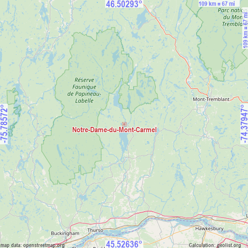
Notre-Dame-du-Mont-Carmel GPS coordinates[2]
46° 1' 0.48" North, 75° 4' 57.324" West
| Map corner | latitude | longitude |
|---|---|---|
| Upper-left | 46.50293°, | -75.78572° |
| Center: | 46.0168°, | -75.08259° |
| Lower-right: | 45.52636°, | -74.37947° |
| Map W x H: | 108.6×108.6 km | = 67.5×67.5mi |
| max Lat: | 73.03752° ⇑62.7% North |
| Notre-Dame-du-Mont-Carmel: | 46.0168° |
| min Lat: | ⇓37.3% South 42.05009° |
| min Long | Notre-Dame-du-M | max Long |
| -139.43328° | -75.08259° | -52.70931° |
| W 57.7%⇐ | ⇒42.3% E |
Elevation
Elevation of Notre-Dame-du-Mont-Carmel is 235 m = 771 ft, and this is 19.4 m = 64 ft below average elevation for this country.
| Max E: |
1518 m = 4980 ft | 39.6% |
| Avg. | 254.4 m = 835 ft | |
| Notre-Dame-du-Mont-Carmel | 235 m = 771 ft | |
Min E: |
-2 m = -7 ft | 60.4% |
See also: Canada elevation on elevation.city.
Geographical zone
Notre-Dame-du-Mont-Carmel is located in North temperate zone (between Tropic of Cancer and the Arctic Circle). Distance of this North polar circle is 2284.6 km =1419.6 mi to North.| Distance of | km | miles | from Notre-Dame-du-Mont-Carmel |
|---|---|---|---|
| North Pole | 4890.5 | 3038.8 | to North |
| Arctic Circle | 2284.6 | 1419.6 | to North |
| Tropic Cancer | 2510.7 | 1560.1 | to South |
| Equator | 5116.6 | 3179.3 | to South |


Nearby cities:
15 places around Notre-Dame-du-Mont-Carmel: (largest is in red/bold)
• Calumet
53.4 km =33.2 mi,  139°
139°
• L'Orignal
53.5 km =33.2 mi,  145°
145°
• La Conception
33.1 km =20.6 mi,  63°
63°
• La Minerve
28.4 km =17.6 mi,  24°
24°
• Labelle
40.1 km =24.9 mi,  42°
42°
• Lac-Simon
30.6 km =19 mi, 59°
• Mont-Tremblant
44.2 km =27.5 mi, 60°
• Montebello
42.4 km =26.3 mi,  164°
164°
• Papineauville
44.8 km =27.8 mi,  173°
173°
• Rivière-Rouge
47.5 km =29.5 mi, 20°
• Saint-André-Avellin
33.4 km =20.8 mi,  177°
177°
• Saint-Faustin
47.6 km =29.6 mi,  76°
76°
• Saint-Émile-de-Suffolk
15.9 km =9.9 mi,  125°
125°
• Thurso
48.1 km =29.9 mi,  195°
195°
• Wendover
49.5 km =30.8 mi, 184°
Sources, notices
• [Note1] Compared only with cities in Canada existing in our database
• [Src1] Map data: © OpenStreetMap contributors (CC-BY-SA)
• [Src2] Other city data from geonames.org with taken over terms of usage.
• [Src3] Geographical zone / Annual Mean Temperature by Robert A. Rohde @ Wikipedia
