Pont Rouge geodata
Pont Rouge (Quebec) is a populated place; located in Canada in America/Toronto (GMT-4) time zone. With population of 7,518 people, there are 380 cities with bigger population in this country. Compared to other cities in Canada, 61.2% of cities are located further ↓South; 76.3% of cities are located further ←West and 55.1% of cities have higher elevation than Pont Rouge. Note1
Administrative division(s):
- Level 1: Quebec
- Level 2: Saguenay/Lac-Saint-Jean
- Level 3: Sainte-Jeanne-d'Arc


Pont Rouge GPS coordinates[2]
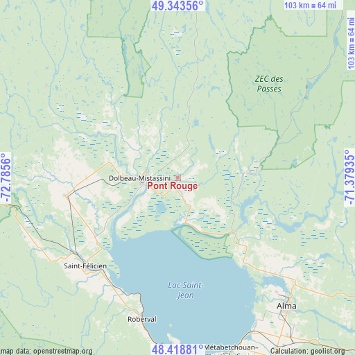
48° 52' 59.952" North, 72° 4' 56.892" West
| Map corner | latitude | longitude |
|---|---|---|
| Upper-left | 49.34356°, | -72.7856° |
| Center: | 48.88332°, | -72.08247° |
| Lower-right: | 48.41881°, | -71.37935° |
| Map W x H: | 102.8×102.8 km | = 63.9×63.9mi |
| max Lat: | 73.03752° ⇑38.8% North |
| Pont Rouge: | 48.88332° |
| min Lat: | ⇓61.2% South 42.05009° |
| min Long | Pont Rouge | max Long |
| -139.43328° | -72.08247° | -52.70931° |
| W 76.3%⇐ | ⇒23.7% E |
Elevation
Elevation of Pont Rouge is 135 m = 443 ft, and this is 119.4 m = 392 ft below average elevation for this country.
| Max E: |
1518 m = 4980 ft | 55.1% |
| Avg. | 254.4 m = 835 ft | |
| Pont Rouge | 135 m = 443 ft | |
Min E: |
-2 m = -7 ft | 44.9% |
See also: Canada elevation on elevation.city.
Geographical zone
Pont Rouge is located in North temperate zone (between Tropic of Cancer and the Arctic Circle). Distance of this North polar circle is 1965.9 km =1221.6 mi to North.| Distance of | km | miles | from Pont Rouge |
|---|---|---|---|
| North Pole | 4571.7 | 2840.7 | to North |
| Arctic Circle | 1965.9 | 1221.6 | to North |
| Tropic Cancer | 2829.4 | 1758.1 | to South |
| Equator | 5435.3 | 3377.3 | to South |


Nearby cities:
15 places around Pont Rouge: (largest is in red/bold)
• Albanel
26.8 km =16.7 mi,  269°
269°
• Alma
48.8 km =30.3 mi,  139°
139°
• Chambord
50 km =31.1 mi,  178°
178°
• Dolbeau-Mistassini
10.9 km =6.8 mi, 267°
• L'Ascension-de-Notre-Seigneur
37.8 km =23.5 mi,  126°
126°
• Metabetchouan-Lac-a-la-Croix
57.1 km =35.5 mi,  157°
157°
• Métabetchouan
57.6 km =35.8 mi, 175°
• Normandin
33.4 km =20.8 mi,  260°
260°
• Pointe-du-Lac
48 km =29.8 mi,  152°
152°
• Roberval
42.2 km =26.2 mi,  195°
195°
• Saint-Bruno
56.2 km =34.9 mi, 145°
• Saint-Félicien
37.3 km =23.2 mi,  226°
226°
• Saint-Gédéon
48.5 km =30.1 mi, 151°
• Saint-Nazaire
50.8 km =31.6 mi, 130°
• Saint-Prime
38.1 km =23.7 mi,  208°
208°
Sources, notices
• [Note1] Compared only with cities in Canada existing in our database
• [Src1] Map data: © OpenStreetMap contributors (CC-BY-SA)
• [Src2] Other city data from geonames.org with taken over terms of usage.
• [Src3] Geographical zone / Annual Mean Temperature by Robert A. Rohde @ Wikipedia
