Saint-Joseph geodata
Saint-Joseph (Quebec) is a populated place; located in Canada in America/Toronto (GMT-4) time zone. With population of 2,576 people, there are 665 cities with bigger population in this country. Compared to other cities in Canada, 64.1% of cities are located further ↑North; 71% of cities are located further ←West and 89.1% of cities have higher elevation than Saint-Joseph. Note1


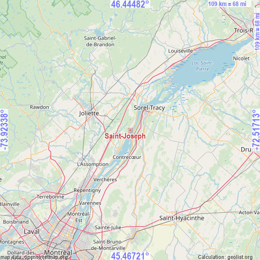
Saint-Joseph GPS coordinates[2]
45° 57' 29.412" North, 73° 13' 12.9" West
| Map corner | latitude | longitude |
|---|---|---|
| Upper-left | 46.44482°, | -73.92338° |
| Center: | 45.95817°, | -73.22025° |
| Lower-right: | 45.46721°, | -72.51713° |
| Map W x H: | 108.7×108.7 km | = 67.5×67.5mi |
| max Lat: | 73.03752° ⇑64.1% North |
| Saint-Joseph: | 45.95817° |
| min Lat: | ⇓35.9% South 42.05009° |
| min Long | Saint-Joseph | max Long |
| -139.43328° | -73.22025° | -52.70931° |
| W 71%⇐ | ⇒29% E |
Elevation
Elevation of Saint-Joseph is 16 m = 52 ft, and this is 238.4 m = 782 ft below average elevation for this country.
| Max E: |
1518 m = 4980 ft | 89.1% |
| Avg. | 254.4 m = 835 ft | |
| Saint-Joseph | 16 m = 52 ft | |
Min E: |
-2 m = -7 ft | 10.9% |
See also: Canada elevation on elevation.city.
Geographical zone
Saint-Joseph is located in North temperate zone (between Tropic of Cancer and the Arctic Circle). Distance of this North polar circle is 2291.1 km =1423.6 mi to North.| Distance of | km | miles | from Saint-Joseph |
|---|---|---|---|
| North Pole | 4897 | 3042.9 | to North |
| Arctic Circle | 2291.1 | 1423.6 | to North |
| Tropic Cancer | 2504.2 | 1556 | to South |
| Equator | 5110.1 | 3175.3 | to South |


Nearby cities:
15 places around Saint-Joseph: (largest is in red/bold)
• Berthierville
14.2 km =8.8 mi,  11°
11°
• Contrecoeur
12.1 km =7.5 mi,  184°
184°
• Crabtree
19 km =11.8 mi,  272°
272°
• Joliette
17 km =10.6 mi,  292°
292°
• L'Assomption
22.1 km =13.7 mi,  227°
227°
• L'Épiphanie
23.6 km =14.7 mi,  239°
239°
• Lanoraie
1 km =0.6 mi,  19°
19°
• Lavaltrie
9.6 km =6 mi,  210°
210°
• Notre-Dame-des-Prairies
19.3 km =12 mi,  301°
301°
• Saint-Denis-sur-Richelieu
20.2 km =12.6 mi,  164°
164°
• Saint-Norbert
24.6 km =15.3 mi,  342°
342°
• Saint-Thomas
11.9 km =7.4 mi, 303°
• Sainte-Élisabeth
18.3 km =11.4 mi,  326°
326°
• Sorel-Tracy
12.4 km =7.7 mi,  41°
41°
• Verchères
21.8 km =13.5 mi, 207°
Sources, notices
• [Note1] Compared only with cities in Canada existing in our database
• [Src1] Map data: © OpenStreetMap contributors (CC-BY-SA)
• [Src2] Other city data from geonames.org with taken over terms of usage.
• [Src3] Geographical zone / Annual Mean Temperature by Robert A. Rohde @ Wikipedia
