Impfondo geodata
Impfondo (Likouala) is a seat of a first-order administrative division; located in Republic of the Congo in Africa/Brazzaville (GMT+1) time zone. With population of 20,859 people, there are 9 cities with bigger population in this country. Compared to other cities in Republic of the Congo, 94.7% of cities are located further ↓South; 100% of cities are located further ←West and 63.2% of cities have higher elevation than Impfondo. Note1


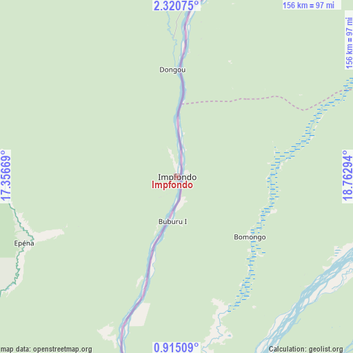
Impfondo GPS coordinates[2]
1° 37' 4.944" North, 18° 3' 35.316" East
| Map corner | latitude | longitude |
|---|---|---|
| Upper-left | 2.32075°, | 17.35669° |
| Center: | 1.61804°, | 18.05981° |
| Lower-right: | 0.91509°, | 18.76294° |
| Map W x H: | 156.3×156.3 km | = 97.1×97.1mi |
| max Lat: | 1.64806° ⇑5.3% North |
| Impfondo: | 1.61804° |
| min Lat: | ⇓94.7% South -4.77609° |
| min Long | Impfondo | max Long |
| 11.8125° | 18.05981° | 18.05981° |
| W 100%⇐ | ⇒0% E |
Elevation
Elevation of Impfondo is 323 m = 1060 ft, and this is 4 m = 13 ft above average elevation for this country.
| Max E: |
790 m = 2592 ft | 63.2% |
| Impfondo | 323 m 1060 ft | |
| Avg. | 319 m = 1047 ft | |
Min E: |
7 m = 23 ft | 36.8% |
See also: Republic of the Congo elevation on elevation.city.
Geographical zone
Impfondo is located in North Torrid zone (between Equator and Tropic of Cancer). Distance of Equator is 179.9 km =111.8 mi to South.| Distance of | km | miles | from Impfondo |
|---|---|---|---|
| North Pole | 9827.2 | 6106.3 | to North |
| Arctic Circle | 7221.3 | 4487.1 | to North |
| Tropic Cancer | 2426 | 1507.4 | to North |
| Equator | 179.9 | 111.8 | to South |


Nearby cities:
4 places around Impfondo: (largest is in red/bold)
• Makoua
323.8 km =201.2 mi,  236°
236°
• Ouésso
223.2 km =138.7 mi,  269°
269°
• Owando
334.9 km =208.1 mi,  225°
225°
• Sémbé
386.7 km =240.3 mi, 270°
Sources, notices
• [Note1] Compared only with cities in Republic of the Congo existing in our database
• [Src1] Map data: © OpenStreetMap contributors (CC-BY-SA)
• [Src2] Other city data from geonames.org with taken over terms of usage.
• [Src3] Geographical zone / Annual Mean Temperature by Robert A. Rohde @ Wikipedia
