Ouésso geodata
Ouésso (Sangha) is a seat of a first-order administrative division; located in Republic of the Congo in Africa/Brazzaville (GMT+1) time zone. With population of 23,915 people, there are 5 cities with bigger population in this country. Compared to other cities in Republic of the Congo, 89.5% of cities are located further ↓South; 94.7% of cities are located further ←West and 52.6% of cities have lower elevation than Ouésso. Note1


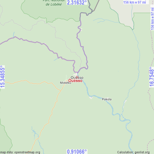
Ouésso GPS coordinates[2]
1° 36' 48.996" North, 16° 3' 6.012" East
| Map corner | latitude | longitude |
|---|---|---|
| Upper-left | 2.31632°, | 15.34855° |
| Center: | 1.61361°, | 16.05167° |
| Lower-right: | 0.91066°, | 16.7548° |
| Map W x H: | 156.3×156.3 km | = 97.1×97.1mi |
| max Lat: | 1.64806° ⇑10.5% North |
| Ouésso: | 1.61361° |
| min Lat: | ⇓89.5% South -4.77609° |
| min Long | Ouésso | max Long |
| 11.8125° | 16.05167° | 18.05981° |
| W 94.7%⇐ | ⇒5.3% E |
Elevation
Elevation of Ouésso is 348 m = 1142 ft, and this is 29 m = 95 ft above average elevation for this country.
| Max E: |
790 m = 2592 ft | 47.4% |
| Ouésso | 348 m 1142 ft | |
| Avg. | 319 m = 1047 ft | |
Min E: |
7 m = 23 ft | 52.6% |
See also: Republic of the Congo elevation on elevation.city.
Geographical zone
Ouésso is located in North Torrid zone (between Equator and Tropic of Cancer). Distance of Equator is 179.4 km =111.5 mi to South.| Distance of | km | miles | from Ouésso |
|---|---|---|---|
| North Pole | 9827.6 | 6106.6 | to North |
| Arctic Circle | 7221.8 | 4487.4 | to North |
| Tropic Cancer | 2426.5 | 1507.8 | to North |
| Equator | 179.4 | 111.5 | to South |


Nearby cities:
6 places around Ouésso: (largest is in red/bold)
• Ewo
308.5 km =191.7 mi,  206°
206°
• Gamboma
388.6 km =241.5 mi,  183°
183°
• Impfondo
223.2 km =138.7 mi,  89°
89°
• Makoua
184.6 km =114.7 mi,  194°
194°
• Owando
233.6 km =145.2 mi, 184°
• Sémbé
163.6 km =101.7 mi,  271°
271°
Sources, notices
• [Note1] Compared only with cities in Republic of the Congo existing in our database
• [Src1] Map data: © OpenStreetMap contributors (CC-BY-SA)
• [Src2] Other city data from geonames.org with taken over terms of usage.
• [Src3] Geographical zone / Annual Mean Temperature by Robert A. Rohde @ Wikipedia
