Owando geodata
Owando (Cuvette) is a seat of a first-order administrative division; located in Republic of the Congo in Africa/Brazzaville (GMT+1) time zone. With population of 23,952 people, there are 4 cities with bigger population in this country. Compared to other cities in Republic of the Congo, 78.9% of cities are located further ↓South; 89.5% of cities are located further ←West and 57.9% of cities have lower elevation than Owando. Note1


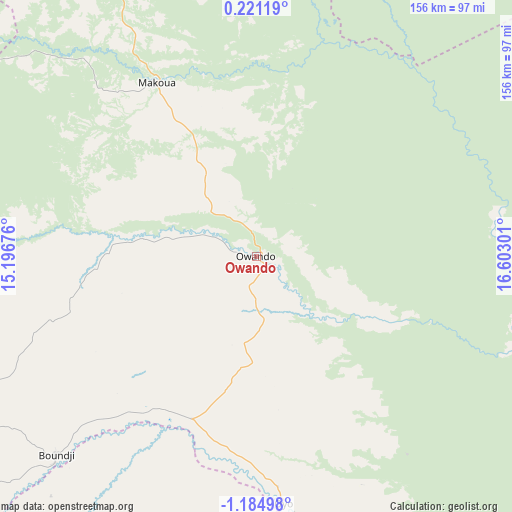
Owando GPS coordinates[2]
0° 28' 54.948" South, 15° 53' 59.568" East
| Map corner | latitude | longitude |
|---|---|---|
| Upper-left | 0.22119°, | 15.19676° |
| Center: | -0.48193°, | 15.89988° |
| Lower-right: | -1.18498°, | 16.60301° |
| Map W x H: | 156.4×156.4 km | = 97.2×97.2mi |
| max Lat: | 1.64806° ⇑21.1% North |
| Owando: | -0.48193° |
| min Lat: | ⇓78.9% South -4.77609° |
| min Long | Owando | max Long |
| 11.8125° | 15.89988° | 18.05981° |
| W 89.5%⇐ | ⇒10.5% E |
Elevation
Elevation of Owando is 355 m = 1165 ft, and this is 36 m = 118 ft above average elevation for this country.
| Max E: |
790 m = 2592 ft | 42.1% |
| Owando | 355 m 1165 ft | |
| Avg. | 319 m = 1047 ft | |
Min E: |
7 m = 23 ft | 57.9% |
See also: Republic of the Congo elevation on elevation.city.
Geographical zone
Owando is located in South Torrid zone (between Equator and Tropic of Capricorn). Distance of Equator is 53.6 km =33.3 mi to North.| Distance of | km | miles | from Owando |
|---|---|---|---|
| Equator | 53.6 | 33.3 | to North |
| Tropic Capricorn | 2552.3 | 1585.9 | to South |
| Antarctic Circle | 7347.6 | 4565.6 | to South |
| South Pole | 9953.5 | 6184.8 | to South |


Nearby cities:
9 places around Owando: (largest is in red/bold)
• Boukiéro
418.9 km =260.3 mi,  189°
189°
• Brazzaville
426.3 km =264.9 mi, 189°
• Djambala
262.4 km =163 mi,  209°
209°
• Ewo
127.6 km =79.3 mi,  250°
250°
• Gamboma
155.1 km =96.4 mi,  181°
181°
• Impfondo
334.9 km =208.1 mi,  45°
45°
• Makoua
61.9 km =38.5 mi,  331°
331°
• Ouésso
233.6 km =145.2 mi,  4°
4°
• Sémbé
278.6 km =173.1 mi, 328°
Sources, notices
• [Note1] Compared only with cities in Republic of the Congo existing in our database
• [Src1] Map data: © OpenStreetMap contributors (CC-BY-SA)
• [Src2] Other city data from geonames.org with taken over terms of usage.
• [Src3] Geographical zone / Annual Mean Temperature by Robert A. Rohde @ Wikipedia
